A strong low pressure center moving up the Atlantic Coast late during the week of 23 October 2017 produced favorable conditions to transport Neotropical migrants on the move, presumably from the southeastern US, far to the north of their intended destinations.


Photos, Alix d’Entremont/Macaulay Library. eBird S40172928.
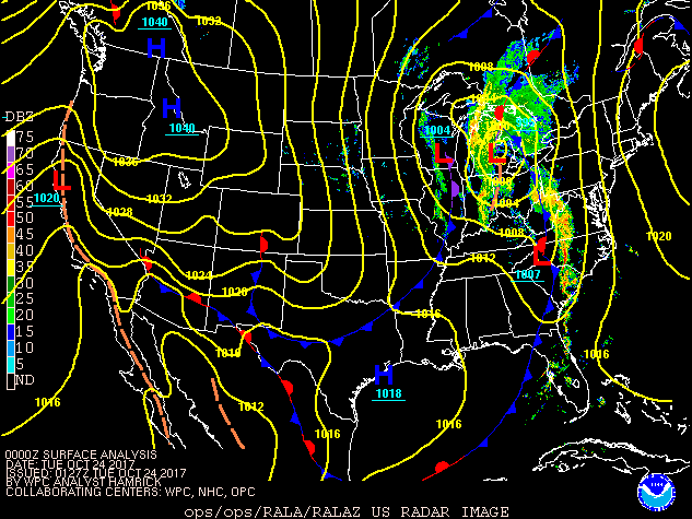
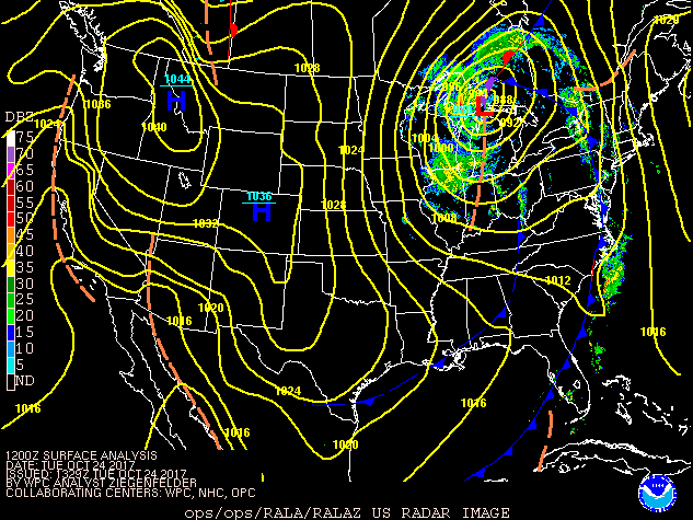
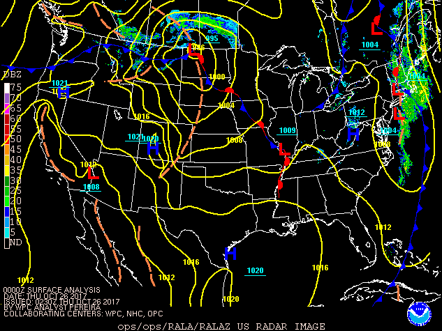
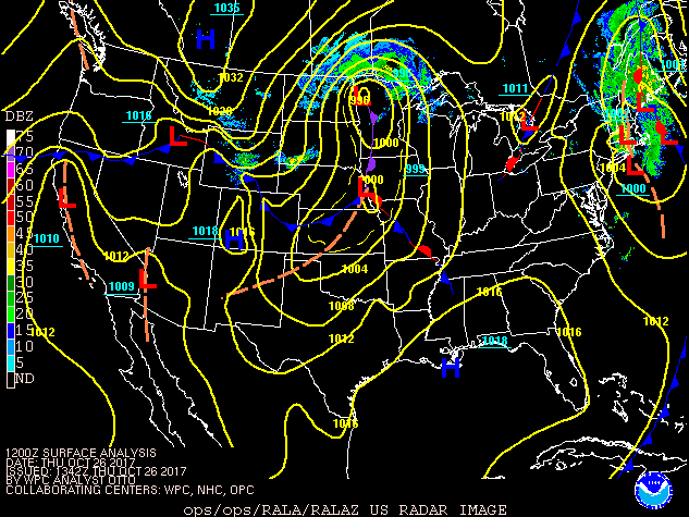
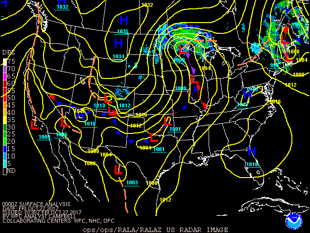
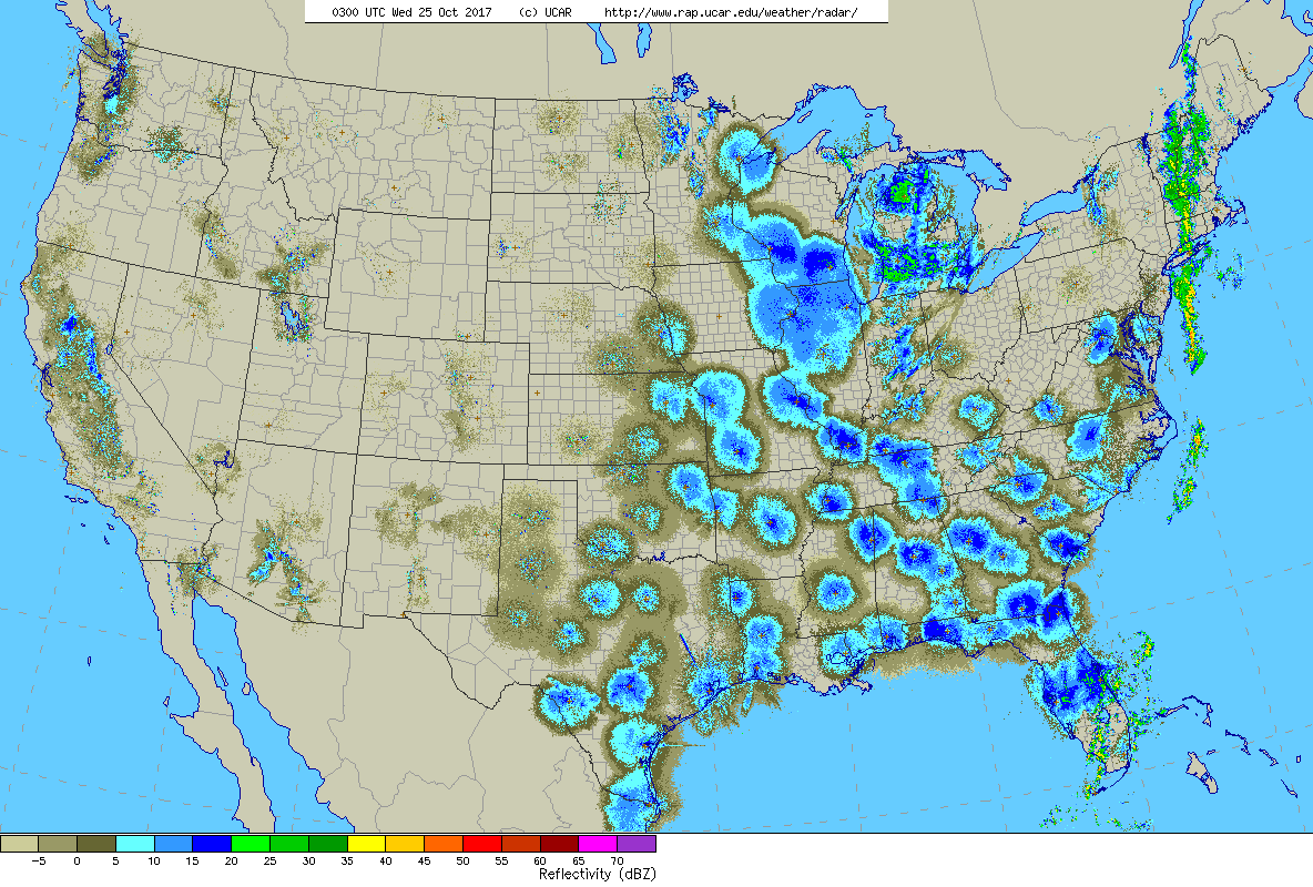
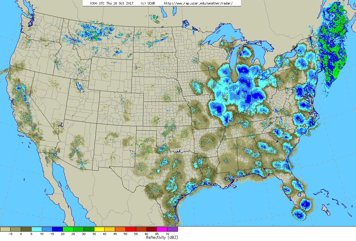
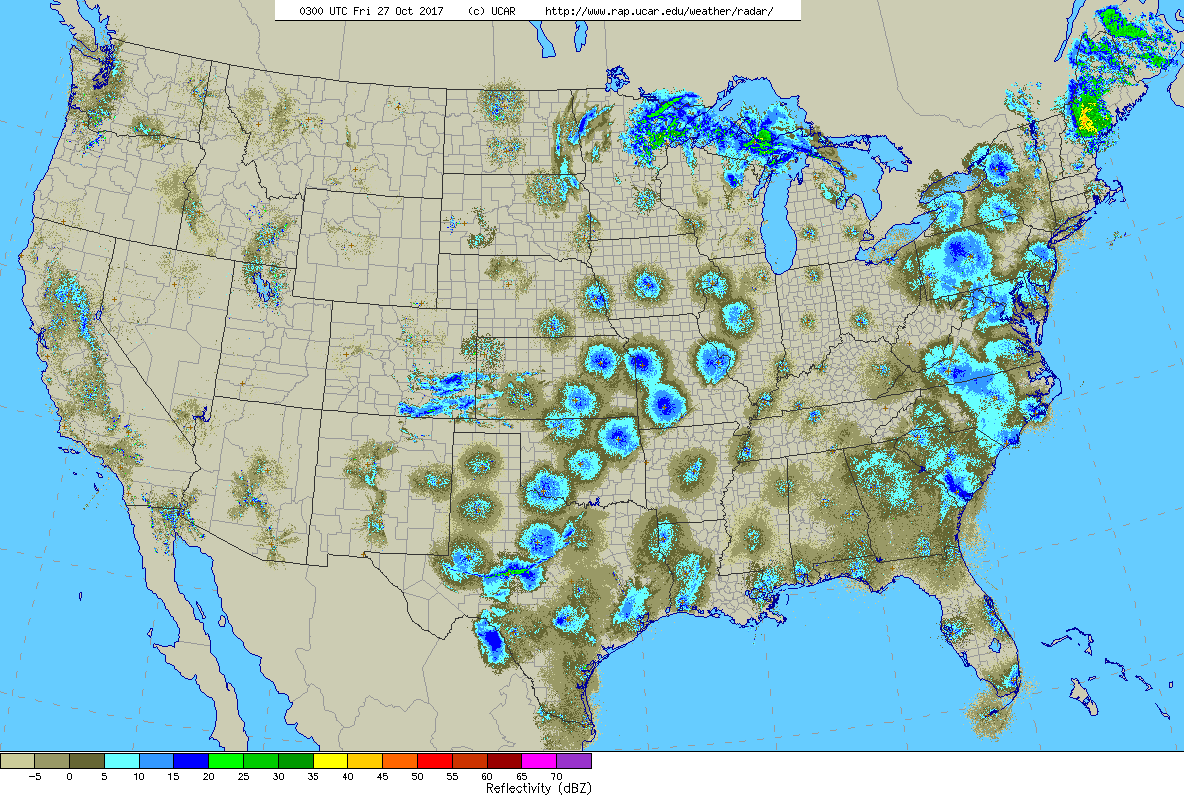
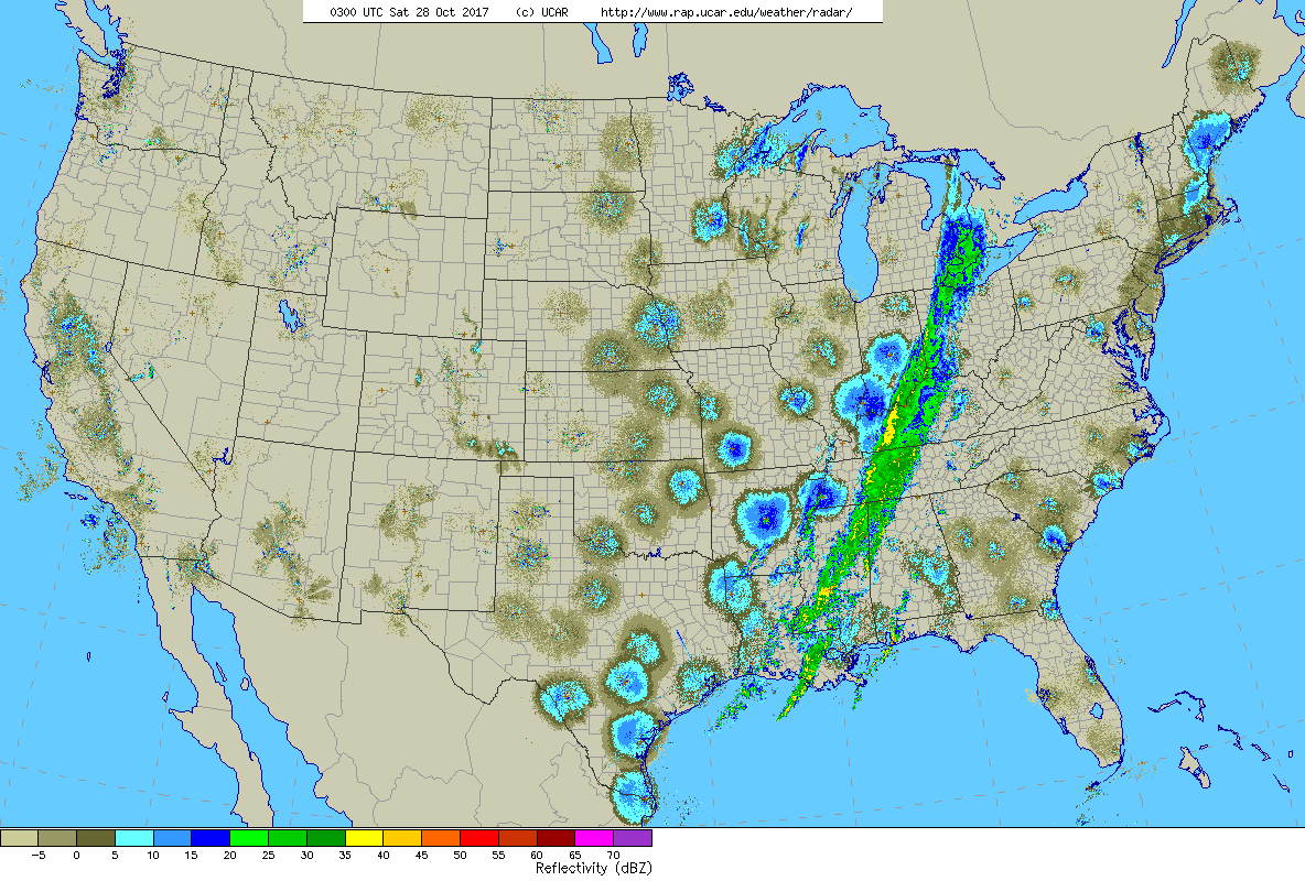
The surface weather map below shows the setup for this event: a cold front with precipitation approaching the southeastern US coast on Monday night 23 October 2017. Note that non precipitation data are not shown in this graphic (see the additional animation below for those data). As the frontal boundary moved over the Atlantic, bands of precipitation and strong southerly flow occurred ahead of the front and northwesterly winds occurred behind the front. The front slowed and then stalled off the coast by 26 October, with patterns of wind direction and speed over several days acting as the primary drivers for entraining migrants into this system. The low pressure center gradually shift north over eastern New England and straight over the Canadian Maritimes, with heavy rain followed by shifting wind direction.
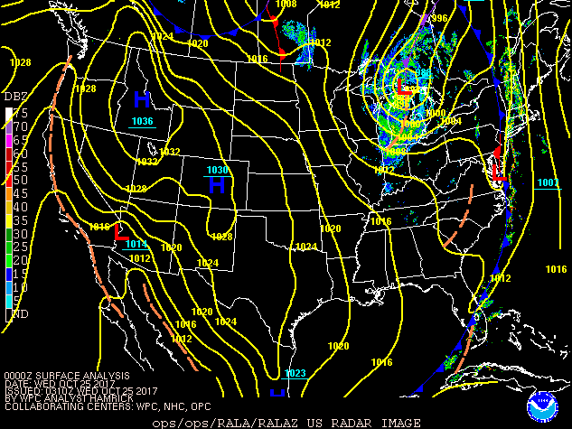
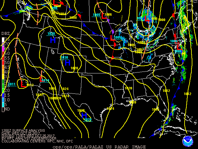
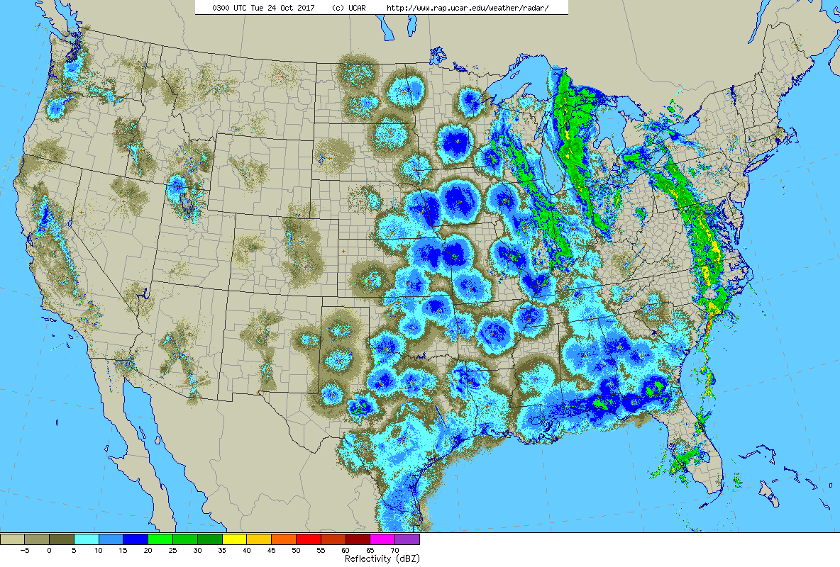
We can also examine the animation below, which contains unfiltered radar data (unlike the animation above). Note the moderate to locally heavy movements on Monday and Tuesday nights in the coastal southeastern US associated with the passage of the cold front we discussed in the above animation. You can see the presence of this front in the animation below by looking for the areas of precipitation on Monday from the eastern Carolinas south to central Florida and on Tuesday from southern Florida north to the Outer Banks of North Carolina and beyond. These bird movements are a likely potential source for the displaced Neotropical migrants that occurred in New England and the Canadian Maritimes.
Reports from Nova Scotia (for example S40188024, S40196982, S40168130) and several locations in New England and even New York highlighted significant numbers of migrants from Thursday into the weekend that arrived in this strong weather system. Although not necessarily an annual occurrence, this pattern is not new. Numerous accounts describing the mechanisms and composition of these movements exist (see this and this for examples), and Team BirdCast has also discussed this pattern. However, our present abilities to summarize data quickly give us the ability to look at these movements as they happen or just afterward in this case. Below is a map showing the occurrence of an incredible diversity of Neotropical migrants transported from points far south of their observation locations on the map.