Update: 4 May 2017, 9:23pm EDT
Team BirdCast is watching the passage of a frontal boundary and how migration proceeds ahead of its movements. We grabbed the image below, a composite of radar data and wind vectors.
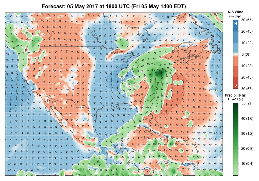
As low pressure moves across the southeastern US and extensive precipitation falls in many areas, birds are migrating over Florida and along portions of the Atlantic Seaboard where rain is not falling. Remember the rain is the blocky and irregularly patterned green, yellow and red, while the biology, probably dominated by birds in many areas, is much more uniform.
Winds are favorable for migration to occur in some portions of New England, New York and New Jersey, as well as in Florida. But note in Florida, in particular, that migrants are moving ahead of the approaching wind shift at the frontal boundary. Additionally, conditions over Cuba and portions of the Caribbean are marginal to locally favorable, in terms of wind directions, for birds to depart toward the continental landmass. Will some of these migrants over and off Florida and over the eastern and northern Caribbean be swept into the westerly flow moving toward and soon to be off Florida into the Atlantic? This is the scenario that creates slingshots of southern migrants, entraining them in atmospheric circulation that carries them far to the north of their intended destinations. Birders in the mid Atlantic, New England, and Canadian Maritime begins should be watchful by this weekend for evidence of this sort of occurrence (Dare we say some spring Atlantic coast Connecticut Warblers, among other species, may be in the mix? We probably should not though we just did).
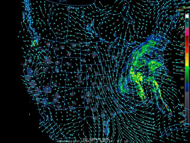
We can also highlight the strong northerly and northwesterly flow over the Great Plains, Texas, and much of the central and western Gulf of Mexico, shutting down most movements in these areas.
Previous post, 4 May 2017, 3:58pm EDT
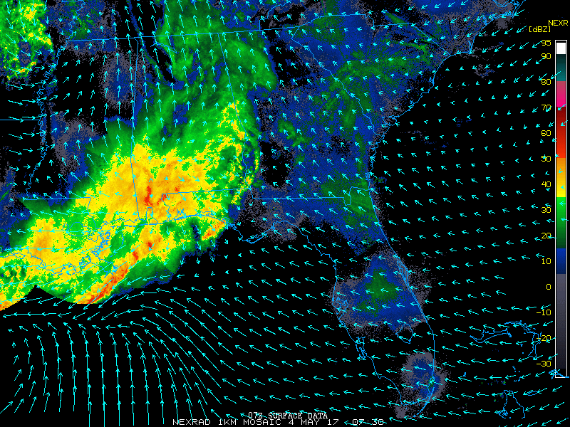
Team BirdCast is looking closely at the current frontal boundary pushing across the southeastern US and pondering what it might mean for those competing in the World Series of Birding 2017, among other birding events presumably scheduled in the coming days. The World Series kicks off at midnight on 6 May in New Jersey, a fun competition drawing birders from far and wide to raise money for critically needed conservation priorities. For this year’s events, let’s look at a snapshot of what’s happening in the east now and also what’s forecast to happen in the next 24-48 hours.
A strong disturbance was moving across the Gulf of Mexico and over the southeastern US by mid morning on 4 May. Migrants interacting with precipitation and northerly flow over the Gulf of Mexico will be coming ashore, with fallout and concentration potential, in portions of the Florida Panhandle and Gulf Coast.
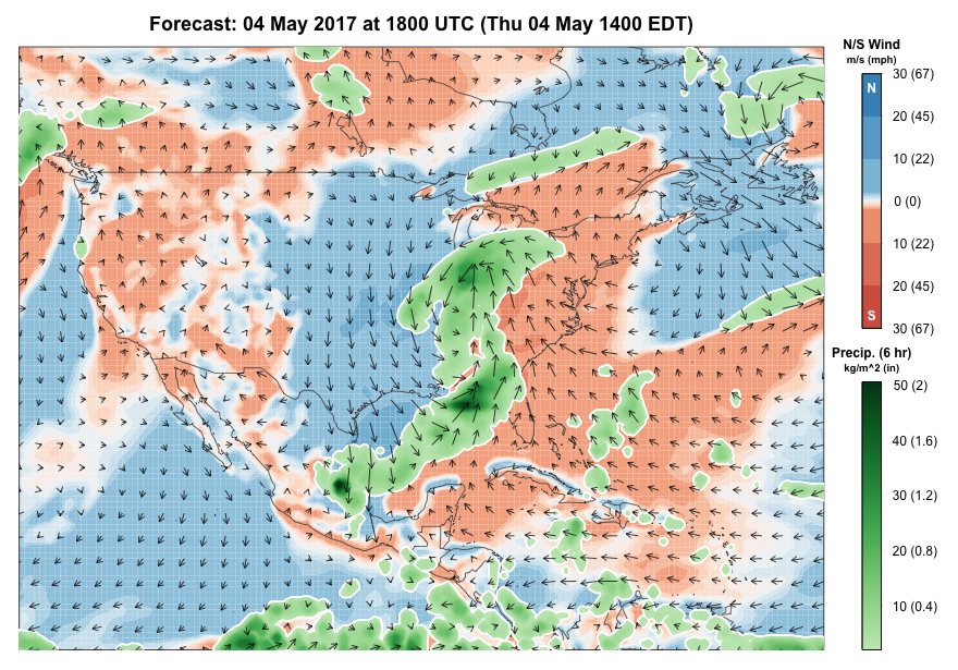
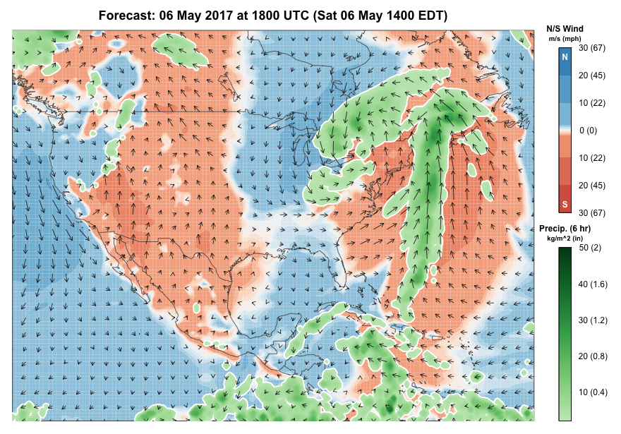
For the remainder of the week, this system is forecast to continue north and east up the Atlantic coast. In addition to bring a tremendous amount of rain to many areas of the Appalachians and coastal plain on Friday, this system has the potential to spawn some locally moderate to heavy flights on Friday night. New Jersey may experience some of these flights, and teams interested in tallying species by nocturnal flight call should be attentive. Additionally, those non-World Series of Birding nocturnal observers should consider listening and watching in areas artificially lit, as some migrants will certainly be aloft in areas free of precipitation. Similar but much less extensive conditions persist on Saturday and Saturday night. For those in the World Series, you may have one last opportunity to score a migrant after dark, as some local movement will likely continue.
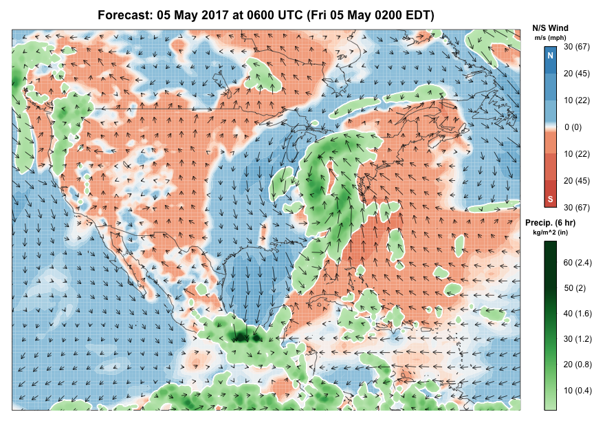
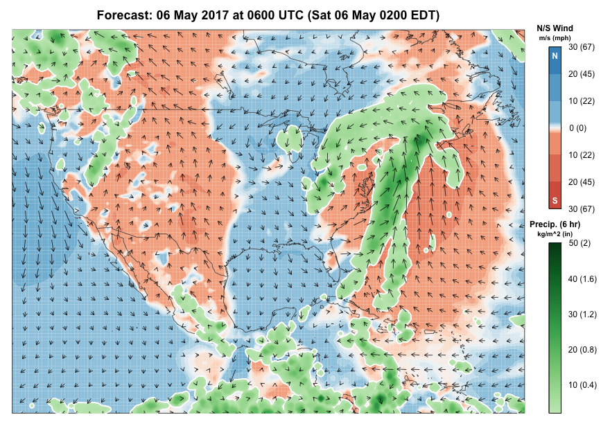
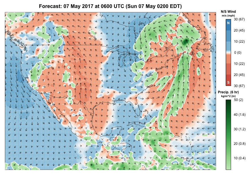
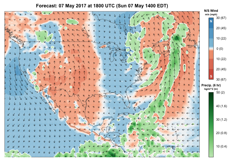
Also worth noting in this imagery is the progression of the frontal boundary to the east and its timing of passage through Florida. There is some potential for this system to collect migrants aloft over the Caribbean and nearshore Atlantic off of Florida. Birders in New England and the Canadian Maritimes should watch this system carefully; although slingshot overshoots of southern vagrants are typically associated with April storms, entrainment of migrants into this system could mean some local concentrations in these areas, particularly on Sunday and early net week.
Team BirdCast will update this post in the coming 12-24 hours.