Team BirdCast is highlighting an area where fallouts and concentrations may occur over the course of the day. An areas of significant storms and precipitation is moving slowly north and east over the western Gulf Coast, impacting Louisiana and nearshore off the immediate coast.
Big rain and big arrivals happening now in the western Gulf. Look out, Louisiana! pic.twitter.com/l6OdxdXASh
— BirdCast–Cornell Lab (@DrBirdCast) May 3, 2017
If we look more closely at the region, and we look at winds in addition to radar information, we see an interesting scenario that developed, and continues to develop. Southerly and southeasterly flow prevailed across much of the western Gulf of Mexico for the morning. The blocky returns typical of rain, some of it intense, was clearly visible in eastern Texas and much of coastal Louisiana. Trans-Gulf migration and some overland migration was occurring on the central and south Texas coasts. And by late morning, a significant trans-Gulf movement begins to arrive to the upper Texas and Louisiana coasts.
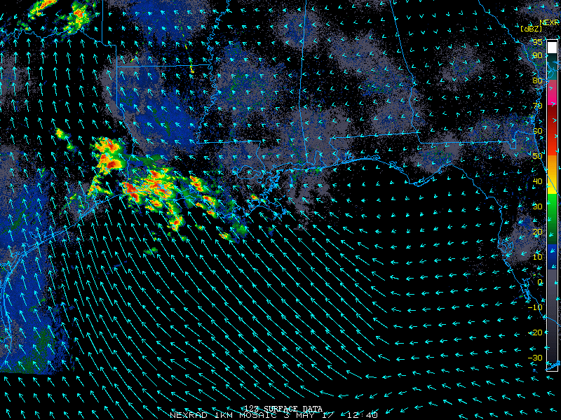
Birds aloft active migration interacting with this extensive area of precipitation and some strong storms will descend immediately into whatever habitat is available. Birders should be watchful in coastal locations and also locations close to but away from the immediate coast for downed migrants. Safety first, of course, as some of these storms are likely very dangerous! Birding second, this afternoon should be interesting on the coast here, so please go out when the coast is clear, of weather literally, and enter those eBird checklists!
Note, from a slightly broader perspective, a frontal boundary is approaching the Gulf of Mexico, and birders should watch carefully in the coming 24-48 hours.
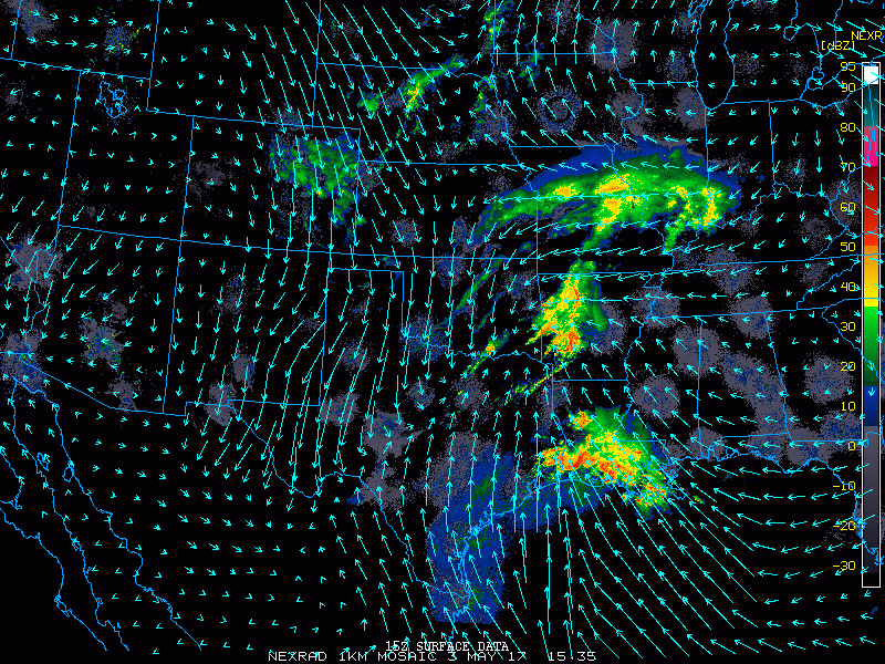
We see the same area of precipitation and trans-Gulf flight as in the above animation. And we also see the circulation of winds relative to the weather and birds. Looking to the north and west, we see wind vectors from the north, representing flow behind the frontal boundary.