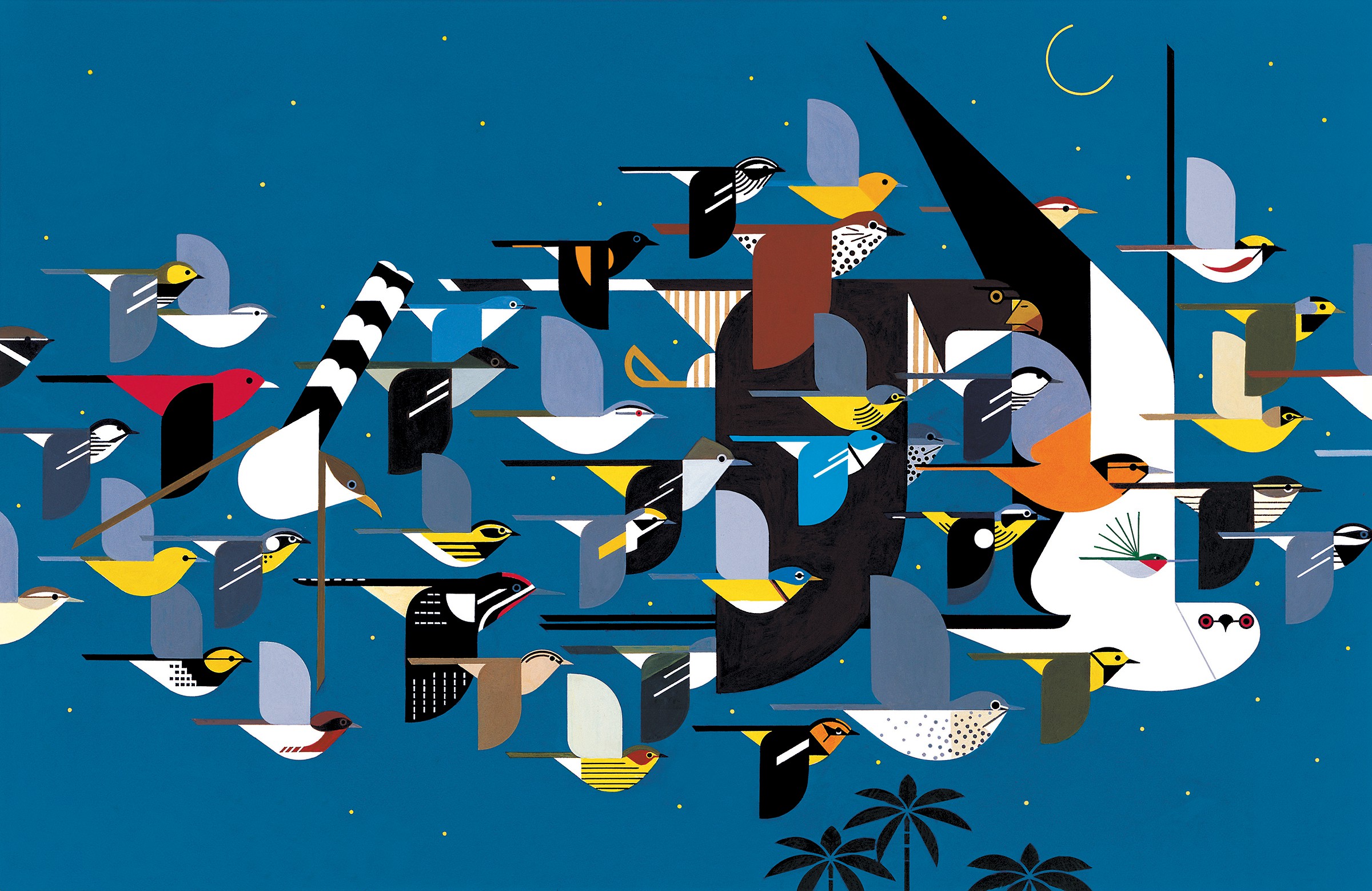
Showcasing the spectacle of bird migration
When, where, and how far will birds migrate? How many birds passed last night? Our tools help you explore the answers to these and many other questions about bird migration.
Learn howPOWERED BY
Migration tools
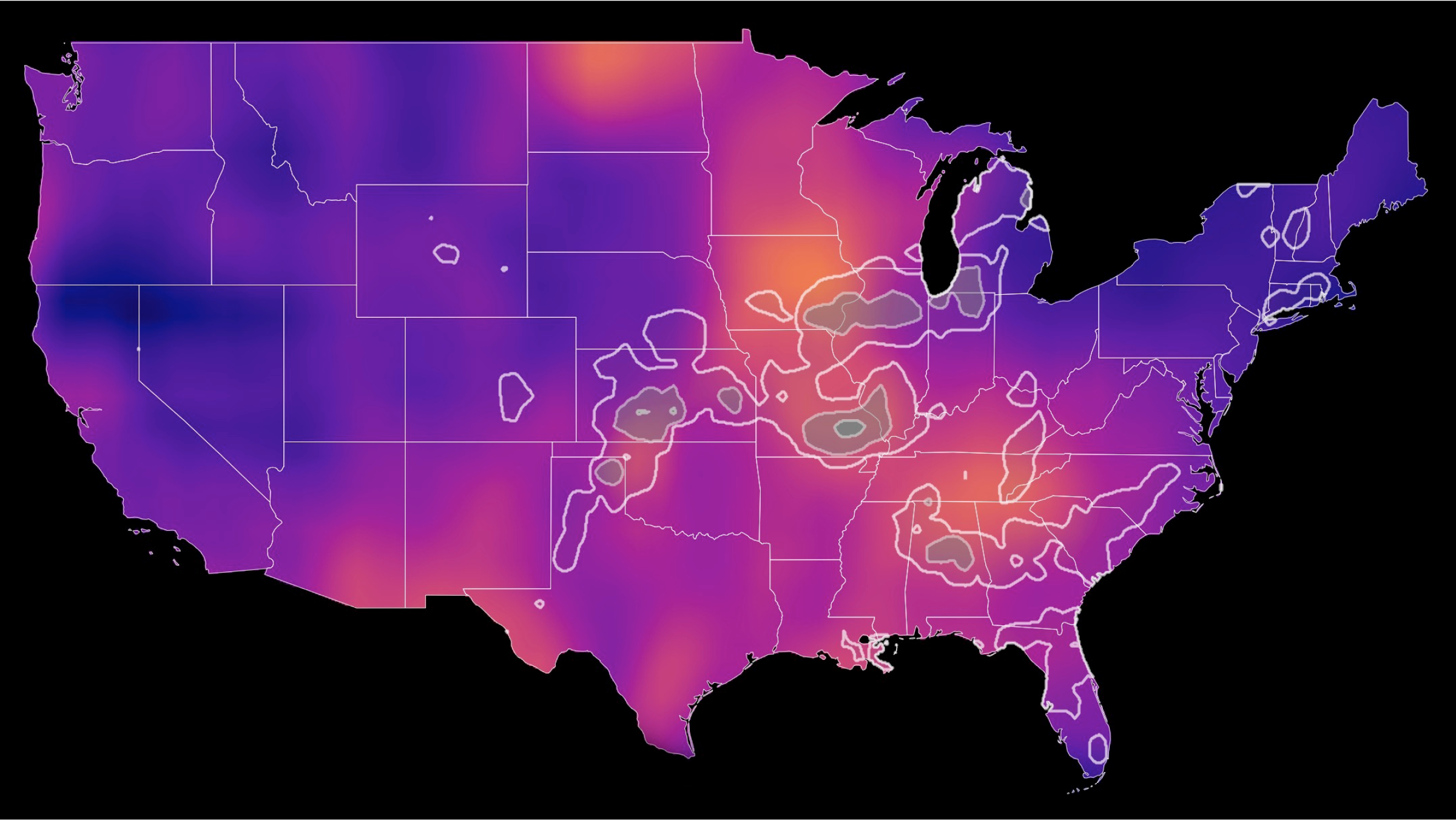
Bird migration forecast maps
Bird migration forecast maps show predicted nocturnal migration 3 hours after local sunset and are updated every 6 hours. Colorado State University and the Cornell Lab of Ornithology currently produce these forecasts.
Learn more
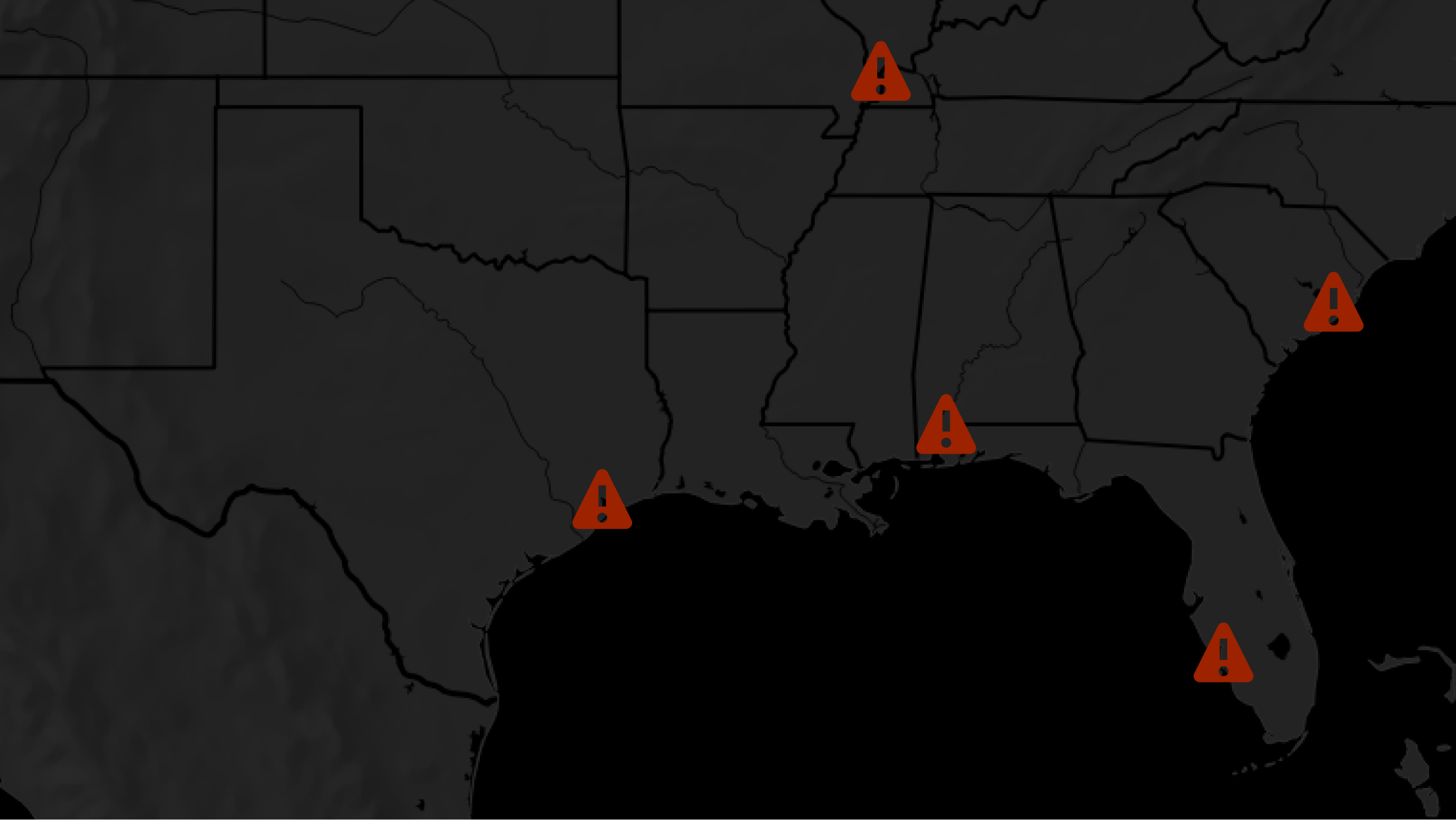
Local bird migration alerts
Search with our local migration alert tool to determine whether birds are passing overhead near your city tonight!
Learn more
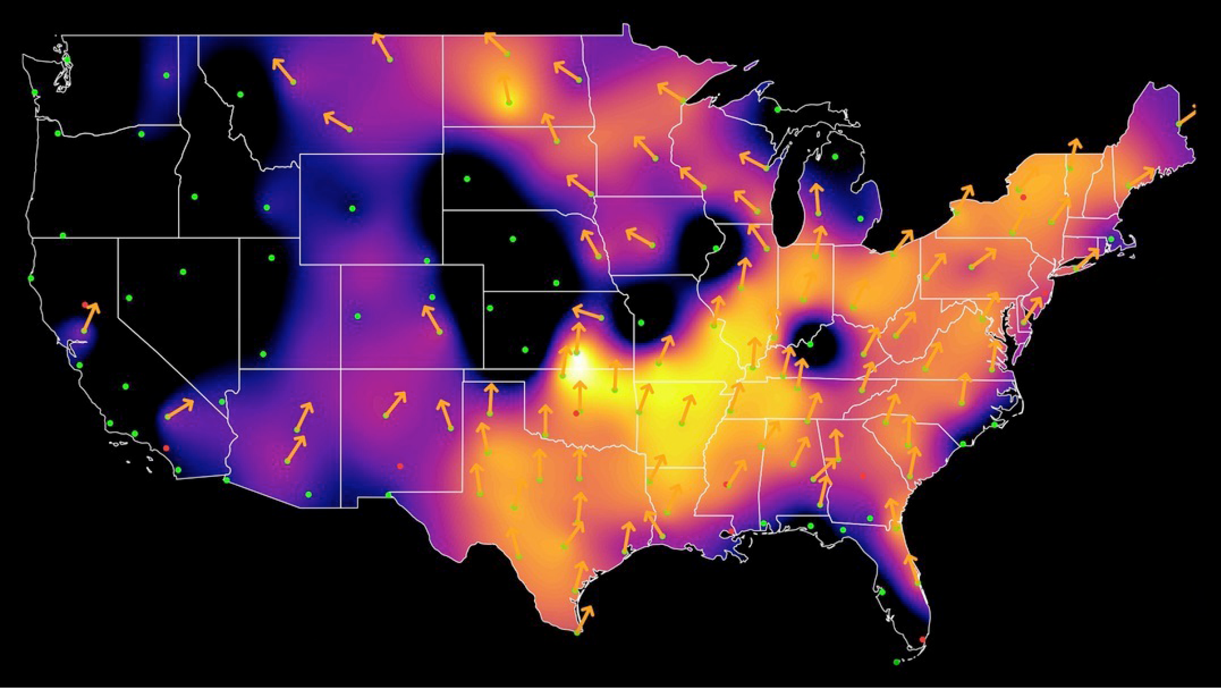
Live bird migration maps
See real-time analysis maps of intensities of actual nocturnal bird migration, as detected by the US weather surveillance radar network between local sunset to sunrise. Cornell Lab of Ornithology currently produces these maps.
Learn more
Recent news
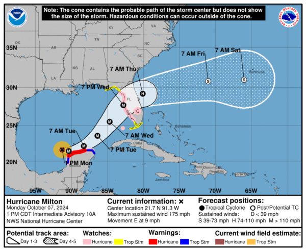
Hurricane Milton is a powerful and very dangerous storm. Birds have been reported traveling in its eye, and as the storm approaches landfall, bioscattered is visible in proximity to the eye of the storm. Read more
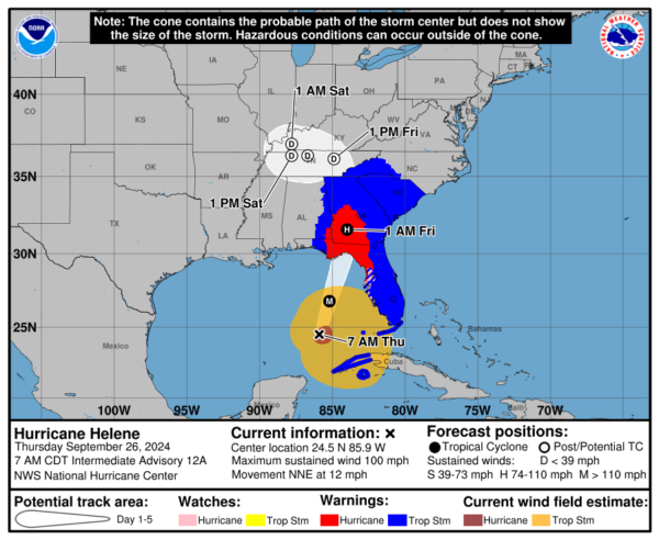
Hurricane Helene is a dangerous storm predicted to make landfall on Thursday afternoon eastern time in the Florida Panhandle. Its circulation will entrain pelagic birds, displace nearshore species, and down overland migrants in many areas of the southeast and probably as far north as Tennessee and maybe even Kentucky, Indiana, and Illinois. We are following the progress of the storm and posting observations here. Read more
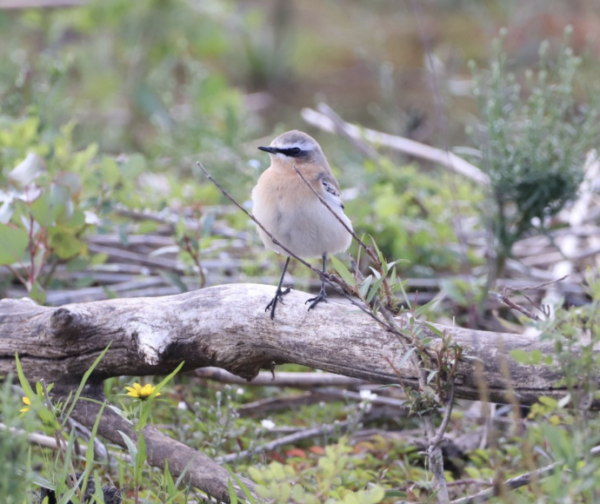
Keep your eyes open for Northern Wheatear in northeastern North American in the coming days - go birding and help make us look good by documenting this species! Time of year and prevailing weather appear to be aligning to warrant us donning our prediction hats! Read more
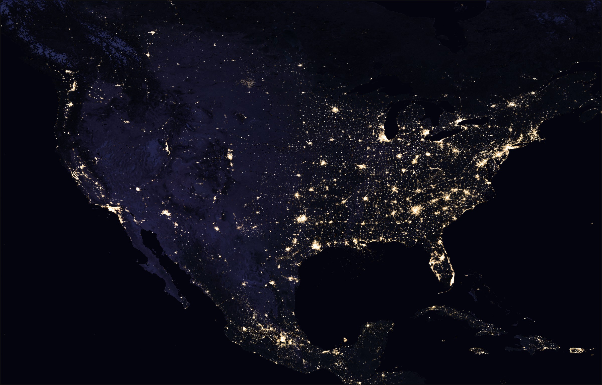
NASA Earth Observatory images by Joshua Stevens, using Suomi NPP VIIRS data from Miguel Román, NASA's Goddard Space Flight Center
Lights Out
BirdCast Partners and Support
BirdCast is a consortium of interdisciplinary researchers, primarily from three organizations at present, with a growing list of collaborators, supporters, and partners. Learn more