On this date four years ago, the BirdCast team posted a story about Northern Wheatears and their occurrence in northeastern North America. Below, we have updated the story to the current year, as the current and predicted weather in the region of the northwestern North Atlantic and northeastern North America looks favorable to spawn some out of range observations of this species and similarly distributed species like Common Ringed Plover.
Northern Wheatear has a large range extending from much of northern Europe and Asia south into North Africa and the Middle East, but also including some areas of the arctic Western Hemisphere (e.g. Alaska, Iceland, and Greenland). This species has the (probably) unique attribute of crossing either the Atlantic Ocean or the continent of Eurasia during its annual cycle. The North American birds breeding in Greenland and northeastern Canada occur rarely but with some regularity in areas of eastern North America. The map below highlights occurrences in September (click the link to explore additional seasonal patterns of this species).
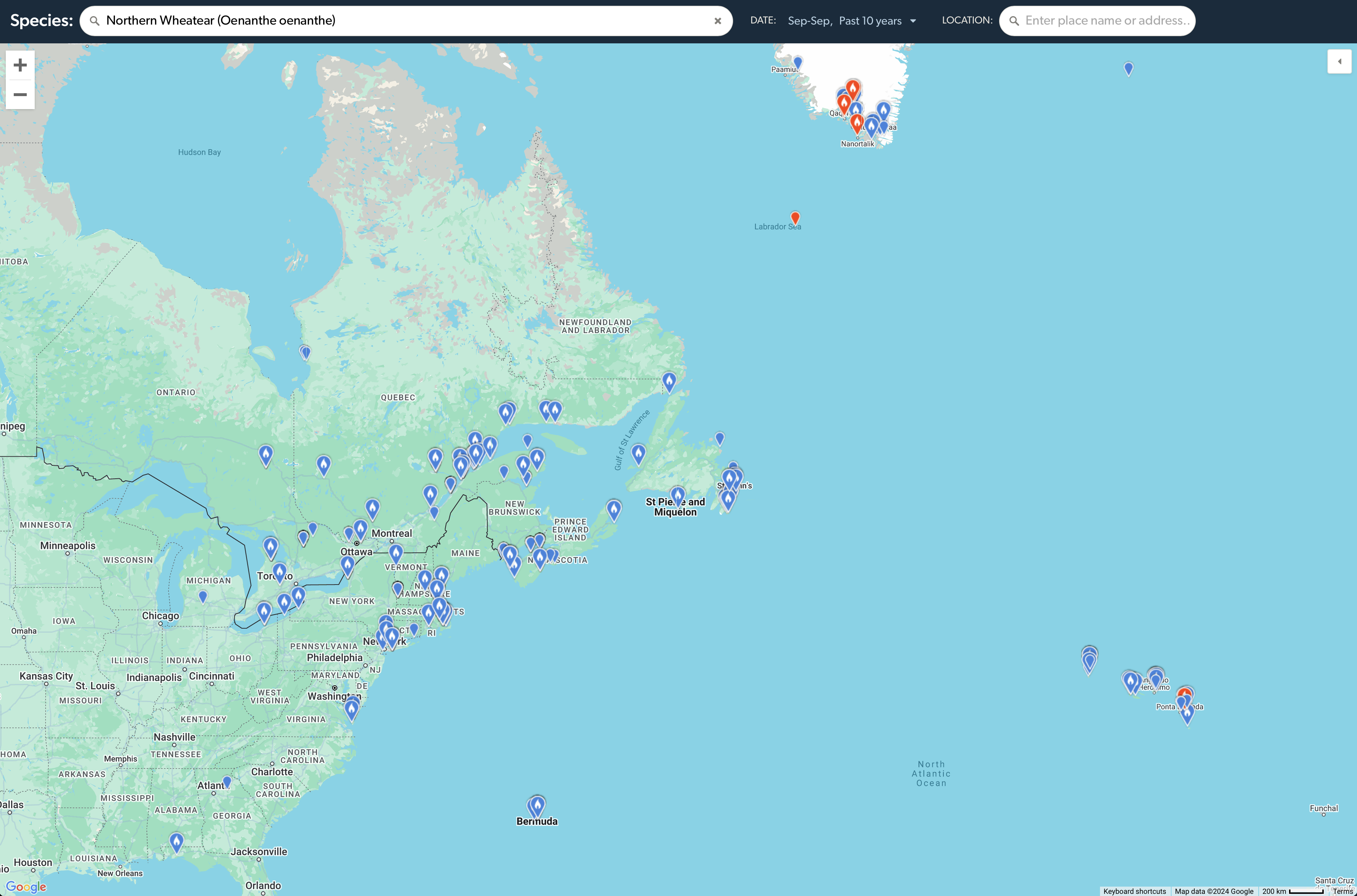
Northern Wheatear occurs annually or almost annually in September (and October) in many areas of eastern North America (the large number of blue balloons on the map). Observations over the last 10 years, including recent observations from points far north and east, in conjunction with prevailing weather patterns (see below), suggest we pose the question: are conditions supportive for this species to occur farther south along the Atlantic seaboard?
Observers along the Atlantic seaboard of the US and Canada (and Bermuda!) should keep a close eye in open habitats, whether coastal dunes or rocky fields, in the coming days, as northeasterly wind flow in the western North Atlantic may carry a small number of wheatears farther west than their usual haunts and routes.
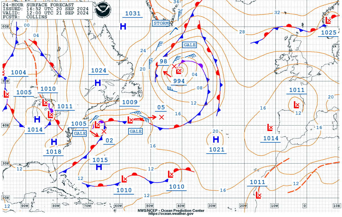
The forecast map for surface conditions in eastern North America and the western North Atlantic highlights the presence of several low pressure systems, including a strong one near Greenland, high pressure (the blue H) in the St Lawrence River valley, and a complex stationary front in the Atlantic. Note the wind barbs, the short blue lines with blue flags (the flags highlight the speed and the direction from which winds are blowing). In this case, see the potential, in terms of winds, to connect Greenland and the Canadian Maritimes and New England.
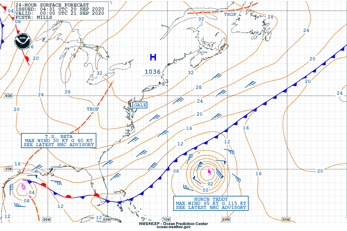
Compare the above map to a map we posted in September 2020, regarding this post:
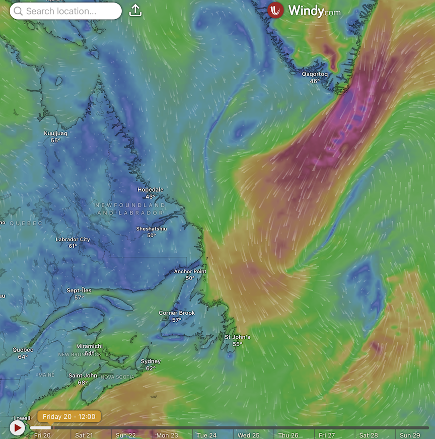
Another perspective on the current weather is shown here, from Windy.com. Note the areas of strong northeasterly winds in the vicinity of Greenland and the Canadian Maritimes.