
Showcasing the spectacle of bird migration
When, where, and how far will birds migrate? How many birds passed last night? Our tools help you explore the answers to these and many other questions about bird migration.
Learn howPOWERED BY
Migration tools
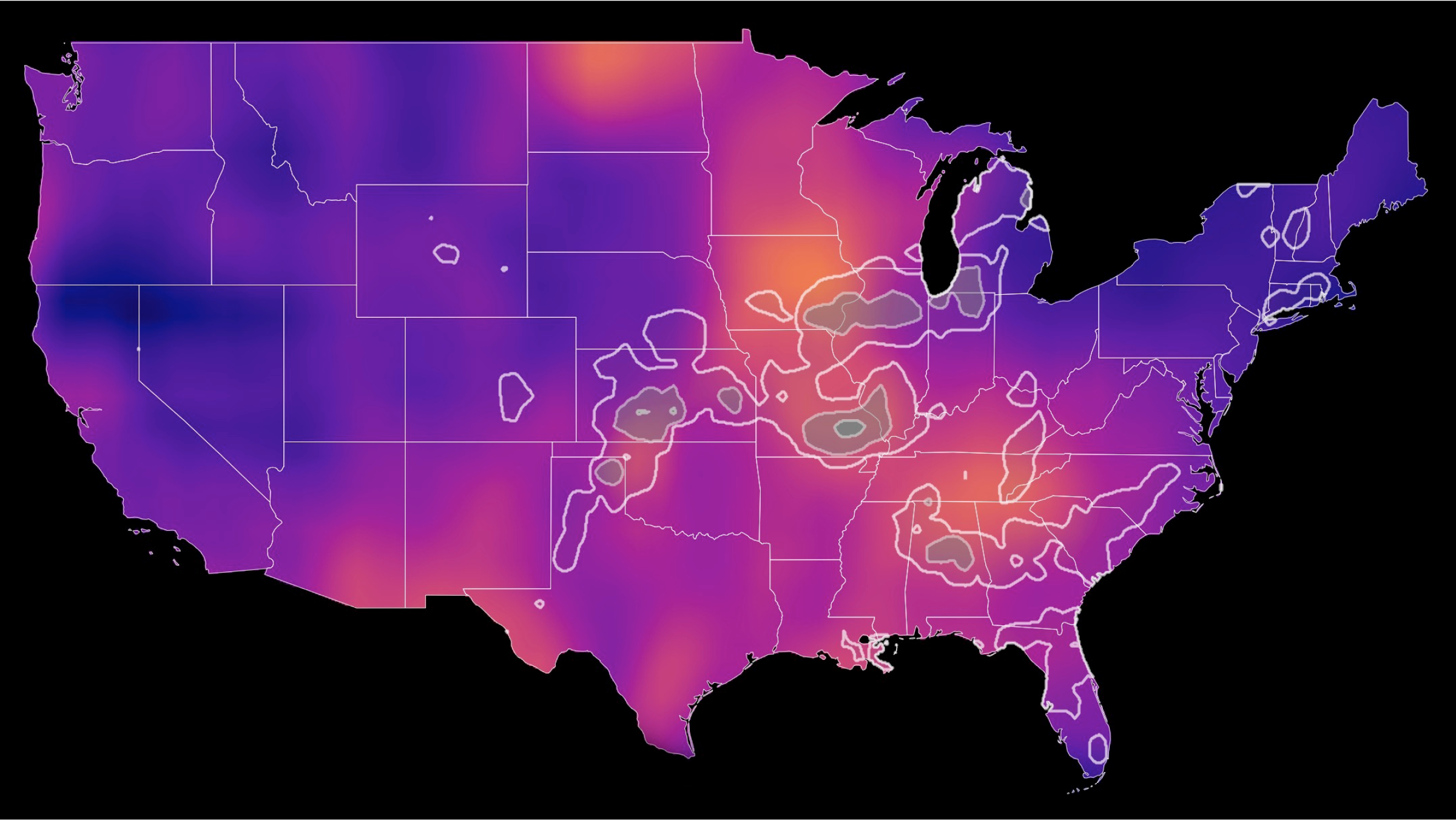
Bird migration forecast maps
Bird migration forecast maps show predicted nocturnal migration 3 hours after local sunset and are updated every 6 hours. Colorado State University and the Cornell Lab of Ornithology currently produce these forecasts.
Learn more
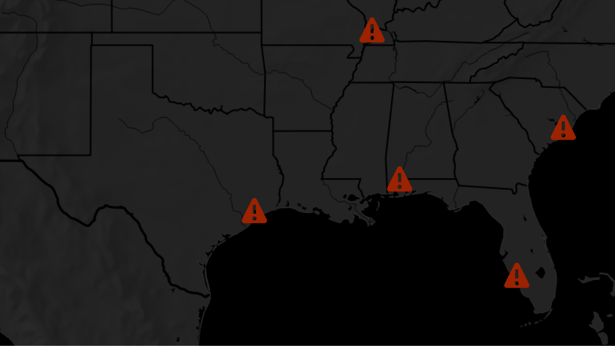
Local bird migration alerts
Search with our local migration alert tool to determine whether birds are passing overhead near your city tonight!
Learn more
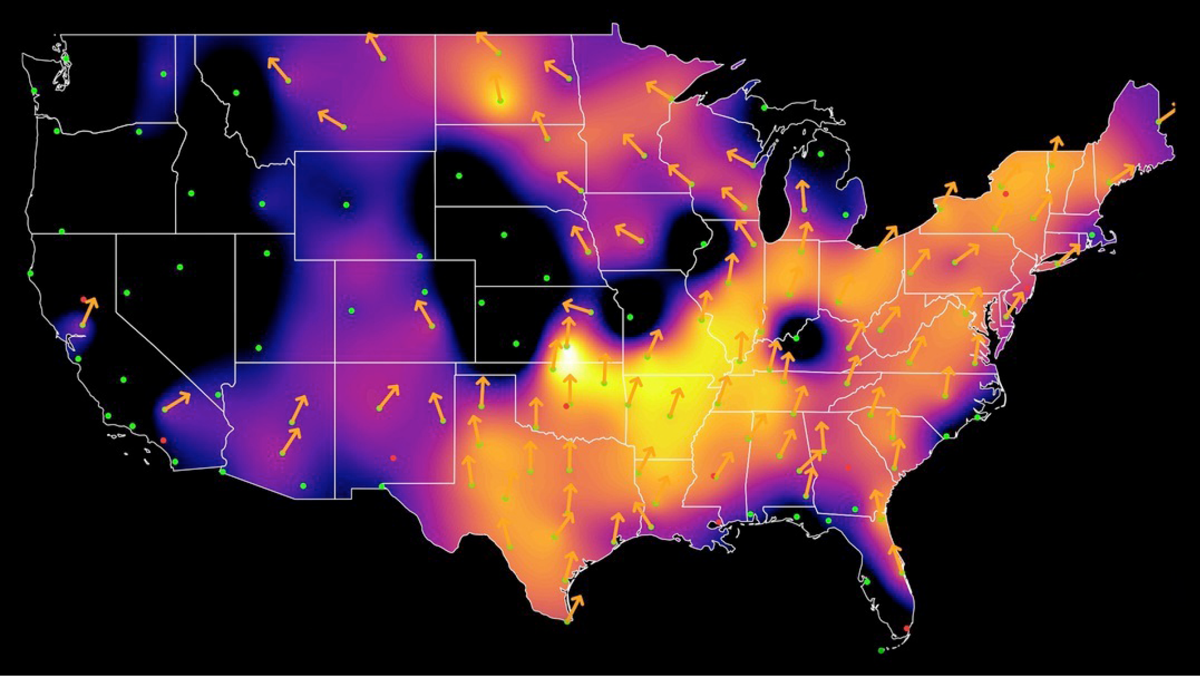
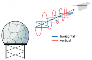
Live bird migration maps
See real-time analysis maps of intensities of actual nocturnal bird migration, as detected by the US weather surveillance radar network between local sunset to sunrise. Cornell Lab of Ornithology currently produces these maps.
Learn more
Recent news
Update: 28 May, 10am ET. The technical issues with the migration forecasts and alerts have now been resolved. Thank you for your patience as we worked through various fixes. Read more
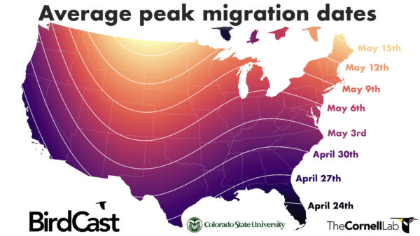
Spring migration is in full swing, and knowing when peak migration will occur in your area is valuable information! Here we provide a sortable table of peak periods of spring bird migration for the largest cities by human population size in the contiguous US. Read more
As a reminder to what the team is working on here at BirdCast, we return to a previous post we wrote. With spring soon arriving and preparations for migration underway, here is a primer on what we do. We turn weather radar data into information on the numbers and flight directions of birds aloft in order to expand the understanding of migratory bird movement. After several years (and hundreds of posts) describing migration, species on the move, and unique migration events, we want you to have a better understanding of what happens at BirdCast. Here is a brief overview and a behind-the-scenes look at the ways we apply radar data to study bird migration. Read more
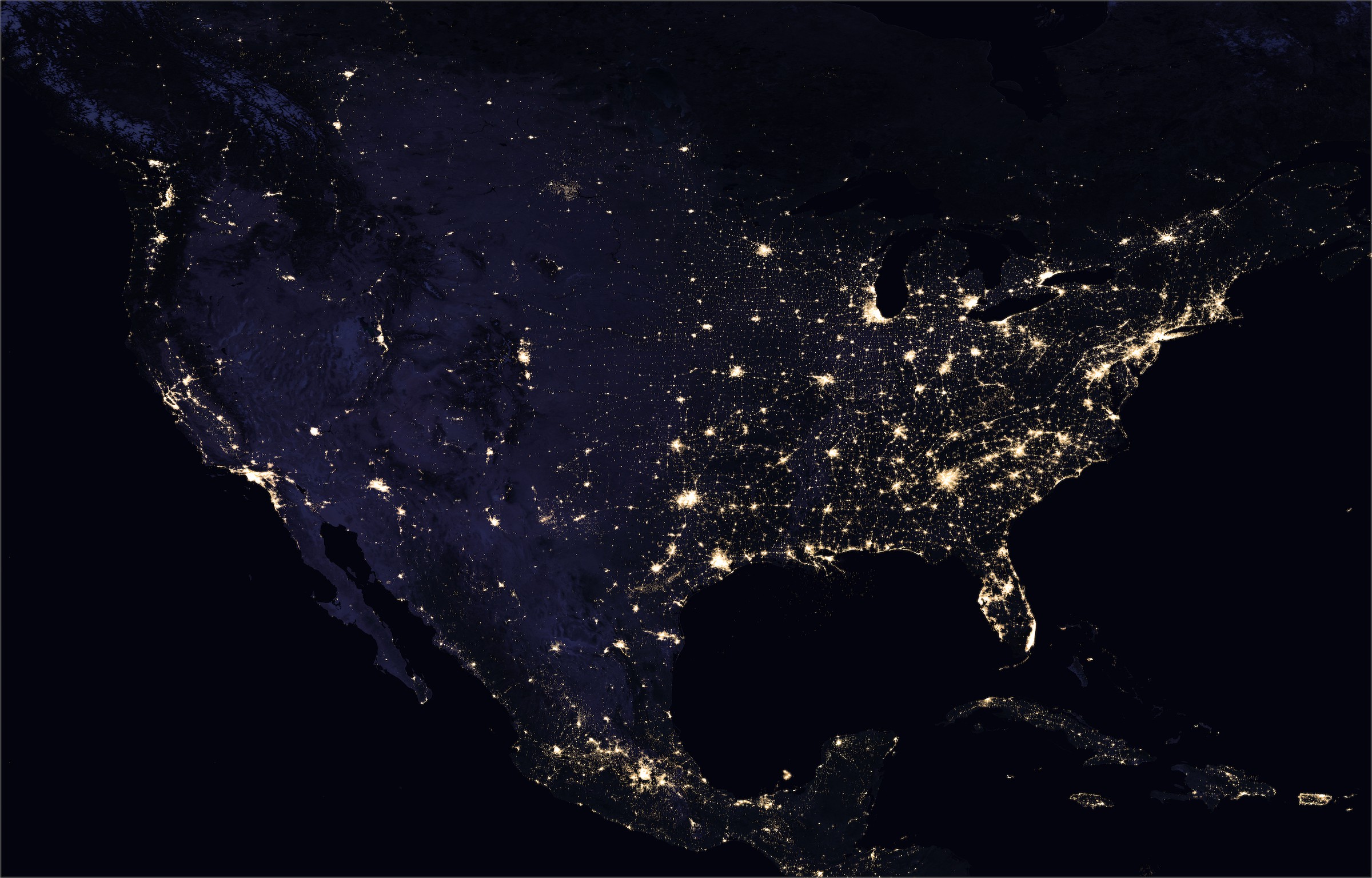
NASA Earth Observatory images by Joshua Stevens, using Suomi NPP VIIRS data from Miguel Román, NASA's Goddard Space Flight Center
Lights Out
BirdCast Partners and Support
BirdCast is a consortium of interdisciplinary researchers, primarily from three organizations at present, with a growing list of collaborators, supporters, and partners. Learn more