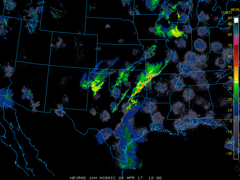
Team BirdCast has been watching the trans- and circum-Gulf movements unfold in the last days. Today’s movement is an exciting one, featuring the arrival of large numbers of migrants and another frontal boundary. The imagery below shows as much: watch the Gulf Coast of Texas and Louisiana, and you will see waves of blues and greens appearing, particularly on the upper Texas and Louisiana coasts. These are birds arriving above the Gulf Coast having completed a trans-Gulf (or perhaps trans-Caribbean) flight overnight. Also note that in north central Texas and the southern Plains states there is a significant frontal boundary with characteristic blocky and irregularly patterns precipitation (some of which is associated with very strong storms). Also note that some evidence of this frontal boundary reaching the coast is evident in east Texas, where it appears that some targets are being “pushed” to the east (i.e. in the westerly winds associated with the air mass boundary). Also note that as this frontal boundary approaches the coast, trans-Gulf migration diminishes markedly, suggesting birds are landing.
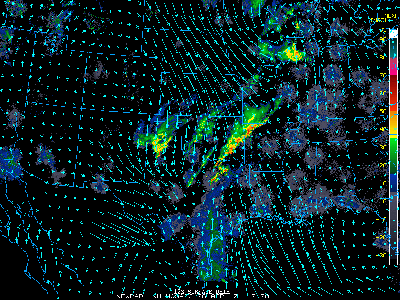
We can also look at the prevailing winds in the lowest reaches of the atmosphere to have a sense of how these movements of trans-Gulf migrants may be moving relative to the prevailing flow. We often think that there is a clear connection in the patterns of arrival locations for these migrants and the speed and direction of the winds aloft. Do you see a pattern here? We also see the unfavorable wind conditions associated with the arrival of a frontal boundary: notice how the wind direction changes over the course of the animation, as northerly as westerly flow arrive close to the coast.
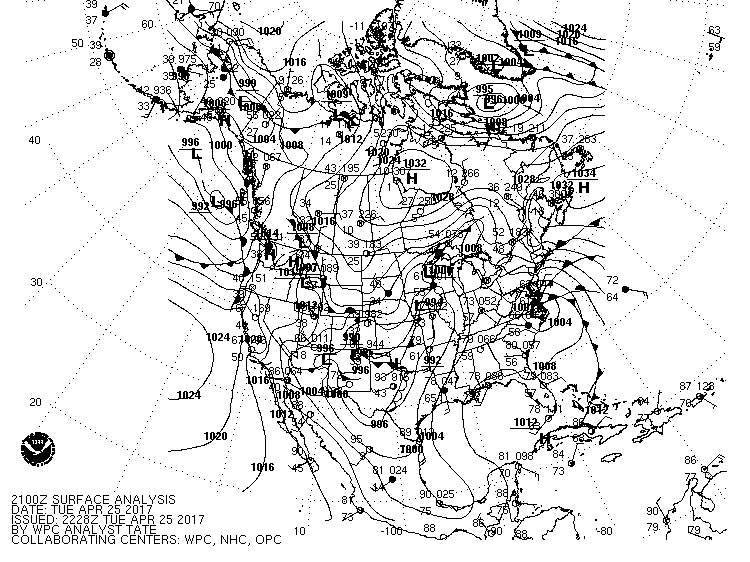
We have surface analysis as well to ponder, observations from meteorological sensors collected across North America. Note the pattern last night in northern Central America and the Yucatan. The dark lines over the Gulf of Mexico indicate lines of constant pressure, isobars, and are a useful proxy to determine the direction and intensity of winds in the immediate vicinity. In this case, given the position of high pressure to the east near Cuba, clockwise circulation around this pressure center, we have southerly flow. This image shows conditions at approximately 530pm CDT, and it is safe to say last night in northern Central American and southern Mexico had favorable migration conditions!