Updated 0946, 10 October 2024
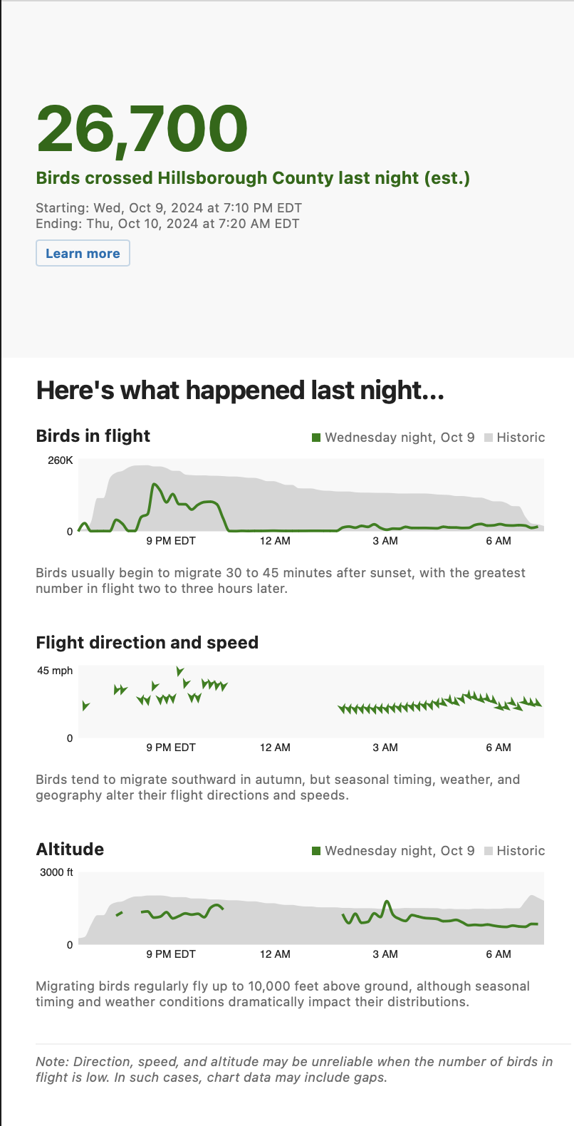
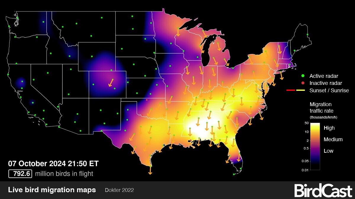
Last night, as Hurricane Milton made landfall near Sarasota, FL, the BirdCast Migration Dashboard highlighted the passage of the eye through Hillsborough County. See in the image below where the pulse of birds aloft corresponds to the arrival and passage of the eye through the county.
Please visit this post for updates and also follow along on this map to see where species are being reported that may become entrained in or displaced by the passage of Hurricane Milton. This is an extremely dangerous storm with powerful and devastating winds, torrential rains, and enormous storm surge, safety (and evacuation from and near projected landfall) is priority number one! If you receive a message regarding a disconnection from the server, please reload.Updated 1809ET, 9 October 2024
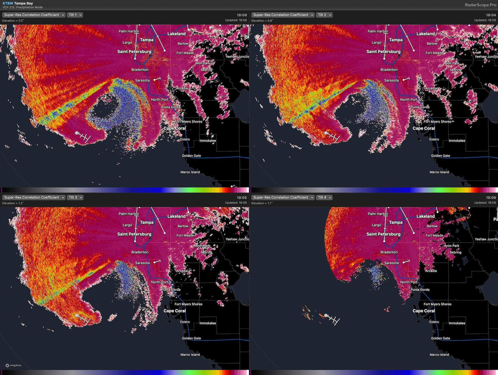
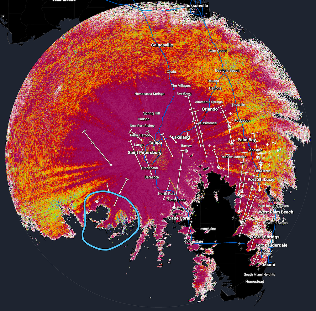
As Milton nears the KTBW radar near Tampa, FL, the four panel figure continues to show that biologicals extend to a significant height above sea level. Again, note the blue pixels. This image shows the biological targets occurring at least to ~3-4km above sea level.
Updated 1653ET, 9 October 2024
There is significant biology in the eye of Hurricane Milton. Here is a four panel figure showing scans from four different tilts, suggesting that the biologicals extend to a significant height above sea level. Again, note the blue pixels. The elevation angles of the radar cover 0.5-1.7 degrees.
Updated 1618ET, 9 October 2024
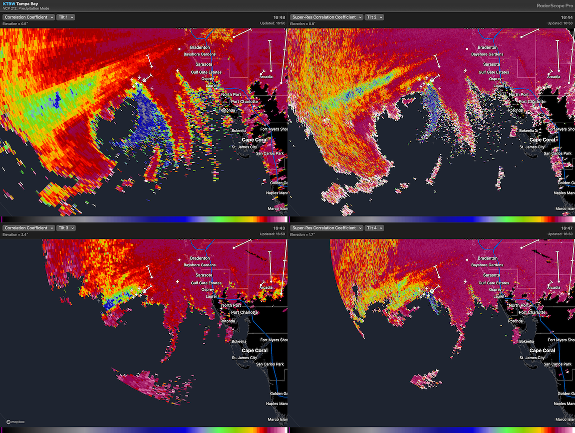
The area of bioscatter in the correlation coefficient imagery is becoming more apparent.
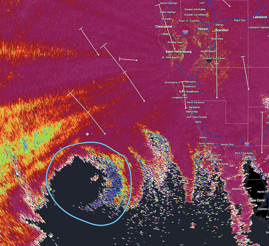
Updated 1534ET, 9 October 2024
Hurricane Milton is a major hurricane, and it is approaching its landfall on the west coast of Florida.
The image below shows the polarimetric radar product “correlation coefficient,” and the circled area (light blue) shows some of the characteristic blue pixels of bioscatter – i.e. birds, insects, bats – entrained in such storms.
Updated 2325ET, 7 October 2024.
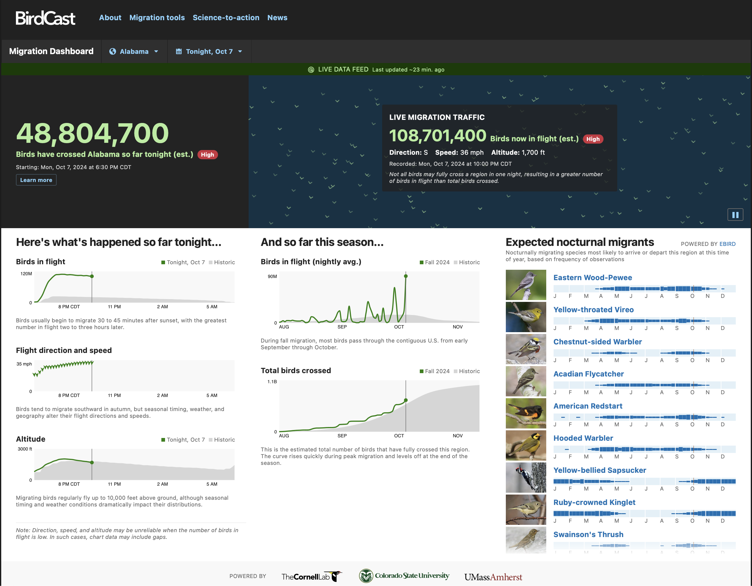
Significant migration is happening in coastal areas of eastern Gulf of Mexico right now. The mosaic below shows a recent “live” migration map, with high intensity movement occurring in Alabama. Based on the speed and direction of these migrants, they will be on a collision course with nasty weather associated with Hurricane Milton sooner rather than later; presumably these birds will become entrained in the storm’s circulation.
A screenshot of the Migration Dashboard highlights the detail of movement in Alabama.
Previous post begins below:
A quick note from the BirdCast team – Hurricane Milton has intensified rapidly into a very powerful and dangerous storm. And with frequent monitoring by aircraft, this amazing information arrived from a recent monitoring flight.
 For those that are students of entrainment of birds by cyclones, this is not new information; however, whether you know about entrainment or whether you are simply awed that birds can fly (sometimes) in these sorts of systems, this is a striking statement from the personnel onboard the aircraft.
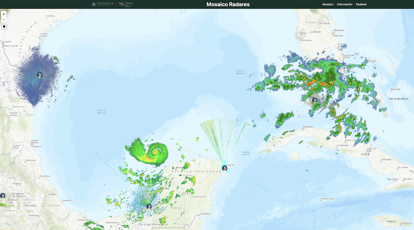
Additionally, although the US radar network that we usually discuss does not cover the origin area or the current path of Milton, the Mexican radar network does have some proximate stations. And in the image below, those familiar with instances of birds appearing on radar imagery will see telltale signs of stippled, uniform patterns to the west of the Yucatán Peninsula at the Sabancuy radar in Campeche.