Our recent post highlighted the slow passage of frontal boundaries in begetting nearly a week of Gulf of Mexico fallout and concentration potential. The coming week has a similar scenario, in this case perhaps even more intriguing – a quick scroll through the Windy.com embedded map below highlights the arrival and movement of two different cold fronts well into the Gulf of Mexico, as well as strong favorable flow east of these fronts in Florida early next week.
19-21 April could see larger than normal trans-Gulf migration arrivals in Florida, given strong southerly and southwesterly flow directly from Yucatán to the Florida Peninsula. These conditions are predicted ahead of the frontal boundary – and for those interested in flight call recording, early next week may be an excellent time to deploy your microphones on the Atlantic Coast of Florida.
Note that behind the boundary (when scrolling through the coming days) migrants in the western Gulf of Mexico will need to contend with the opposite set of conditions – head winds (northerly primarily) behind the frontal boundary. These conditions will slow or stop the flow of most trans-Gulf migration into Texas and the western Gulf of Mexico, forcing birds moving in these areas to fly overland (i.e. circum-Gulf migration).
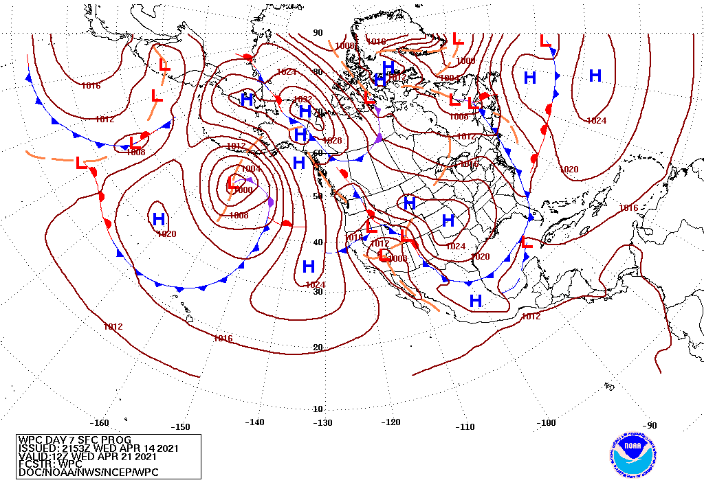
For additional visuals to describe the movement of frontal boundaries from a broader, more hemispheric perspective, see the animation below. Note the presence and extent of the cold fronts (the blue lines with blue triangles) in the 3-7 day forecasts.
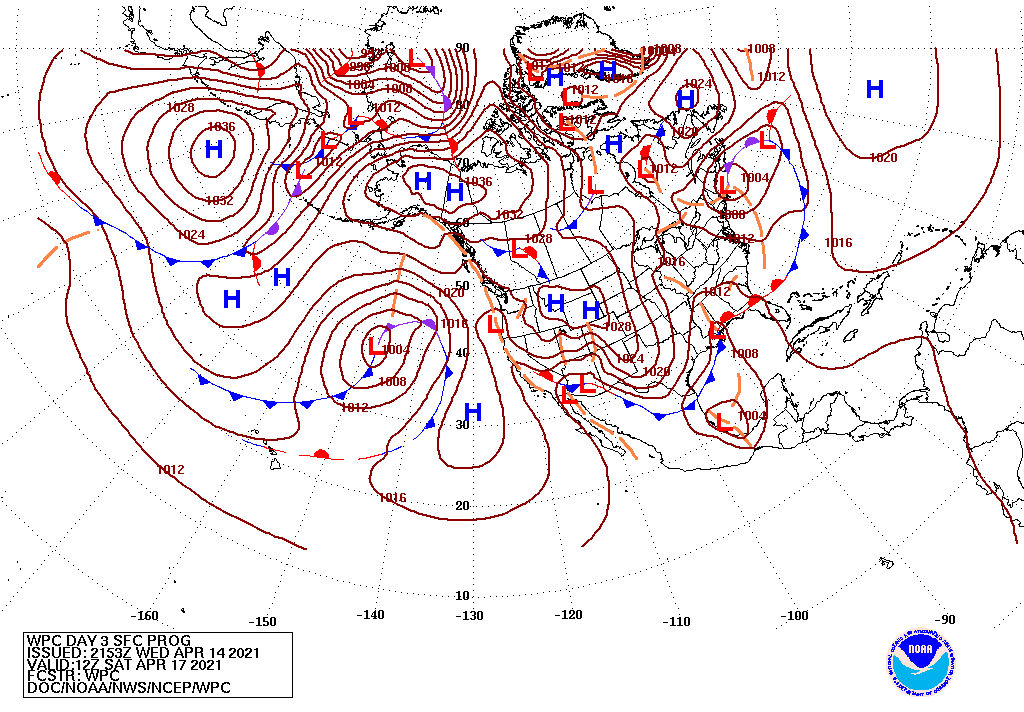
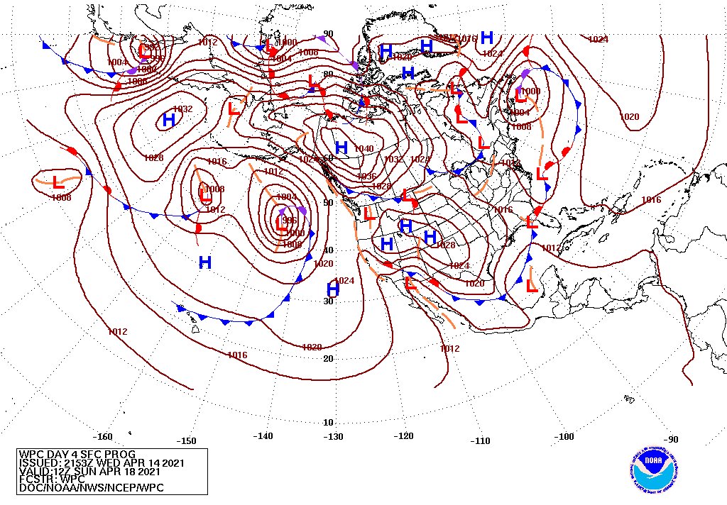
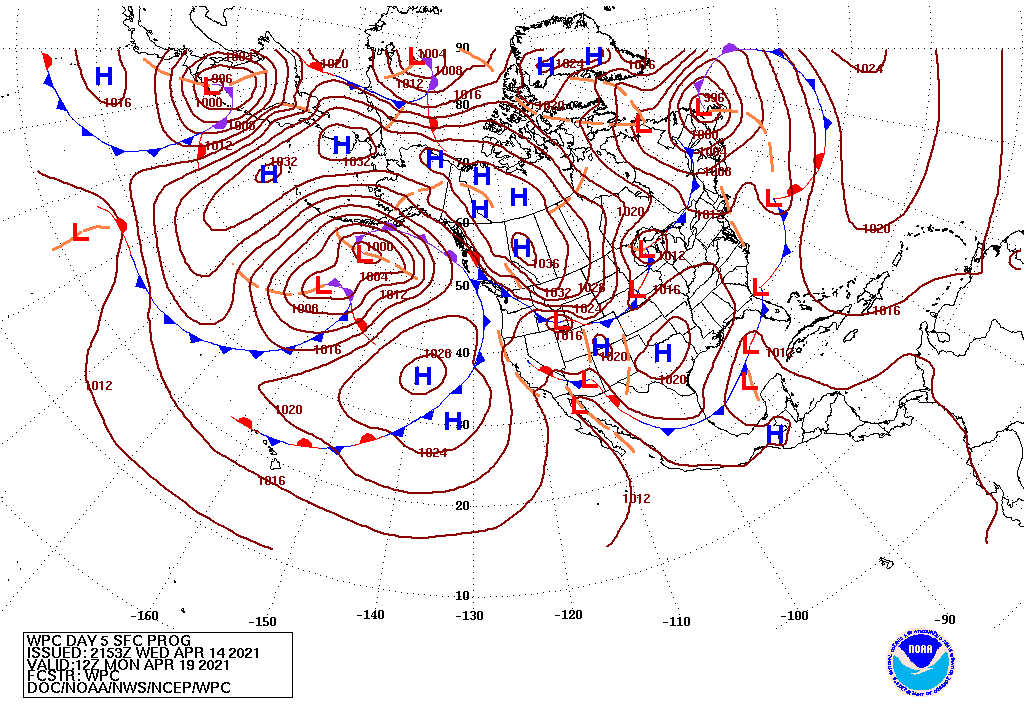
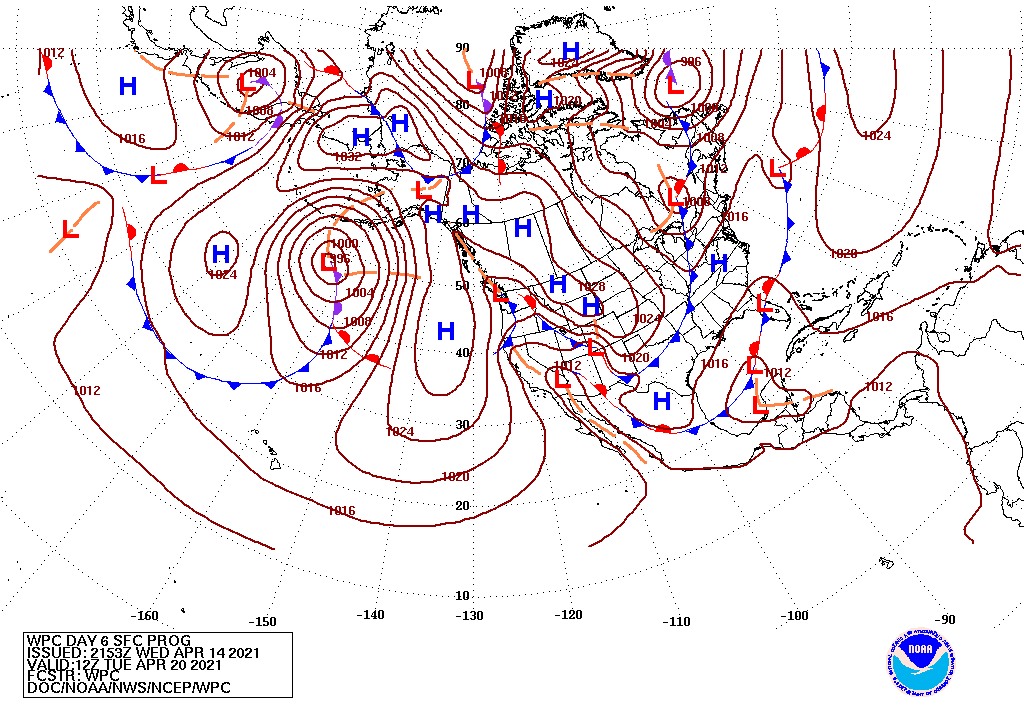
The extensive frontal boundaries and their relatively slow movement in and through the region will delay arrivals of many inbound migrants. Depending on the duration and strength of these weather systems, some waves of species’ arrivals may be delayed as much as one week, particularly in the central US (review this post to see the potentially impacted species in the Great Plains and Southeast).
In addition to impacts on seasonal migration, other species may be affected by the predicted patterns of winds. We have already seen Fork-tailed Flycatcher appear in the southeastern US this spring, and early to mid week next week will be a good window to keep a keen eye to fence lines and emergent twigs and branches for this species. Strong steering flow between South America and the southeastern US is the foundation of our logic – in addition to this species, birders should keep a close eye for other South American flycatchers and austral migrant species.
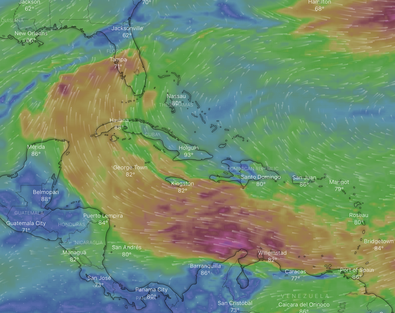
Strong winds aloft in the Caribbean Sea north of South America could propel an interesting array of southern vagrants to the southeastern US early to mid week (19-21 April).
We will continue to update this post as new weather forecasts are posted.