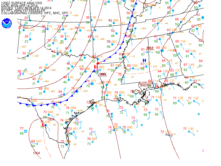
As forecast last week, a frontal boundary is approaching the Texas and Louisiana coasts this morning. The map below shows the current conditions in Texas and along the Gulf Coast. Note that barbs and wind flags represent the direction from which winds are blowing, and the blue line with triangles is the boundary between warm and cool air masses (the frontal boundary; i.e. the cold front). The front as of the morning of 14 April divides an area of southerly flow to its east and northerly flow to its west.
 Radars along the coast at Brownsville, Corpus Christi, Houston, Lake Charles, and Slidell show inbound trans-Gulf migrants in flight (the uniform stippled patterns). These radars, along with several that are farther inland, also show precipitation (the blocky and irregular patterns). As the frontal boundary and associated unfavorable winds and rain reach and push off the coast, migrants interacting with these conditions will drop and seek the closest available habitat. Birders should plan their days accordingly, watching for migrant dropouts of shorebirds and larger passerines to begin earlier in the day, followed by smaller passerines in the afternoon. Migrants traps would be good afternoon destinations, as numbers of birds will build into available habitat as the day progresses and more birds fly into the unfavorable conditions.
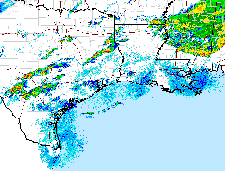
Migration Alert, Gulf Coast: 14 April 2014
NEWS CATEGORIES
POWERED BY