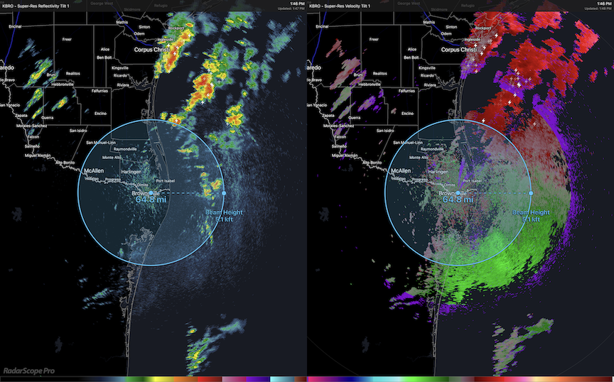
Birds are on the move over the Gulf of Mexico right now. This image highlights movements happening now over water from the Brownsville, TX and Houston, TX weather surveillance radars. Note, patterns we typically associate with migrating birds – uniform, stippled patterns that contrast with the blocky and irregular patterns of precipitation – are apparent to the east of the lower Texas coast (left panels of each image). Also note that, at the distance from the radar indicated by the 64.8 mile radius circle centered on the radar station, trans-Gulf migrants are flying in the radar beam sampling the atmosphere at 5,000 ft above the surface of the Gulf of Mexico. These birds are generally moving to the north or northwest (the right panels of the images show the velocity and direction of movement – green, inbound, to red, outbound).
 Conditions have been good today for birds to move over the Gulf of Mexico, with strong southerly and southeasterly winds aloft several thousand feet above the water; but these conditions are changing dramatically with an arriving low pressure center and an unstable frontal boundary. The Windy.com map below illustrates this change, visible as circulation in southern Texas.
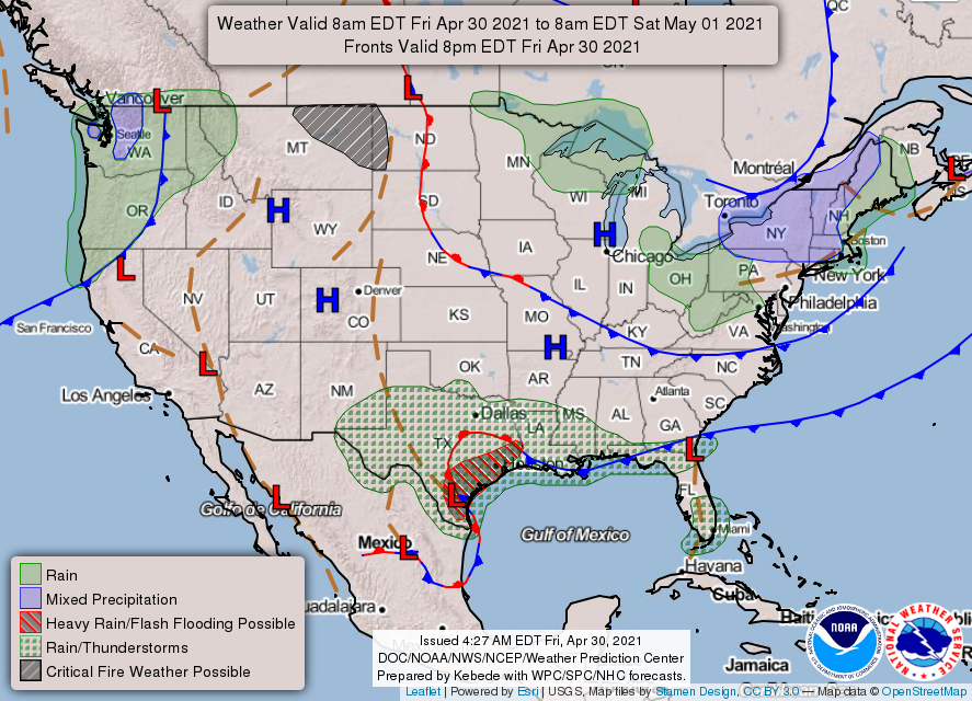
The graphic below highlights this complex frontal stall and areas where significant precipitation was predicted, and is currently, falling. Birders along the Texas coast should plan to visit – where and when they can do so safely – coastal habitats from Brownsville to
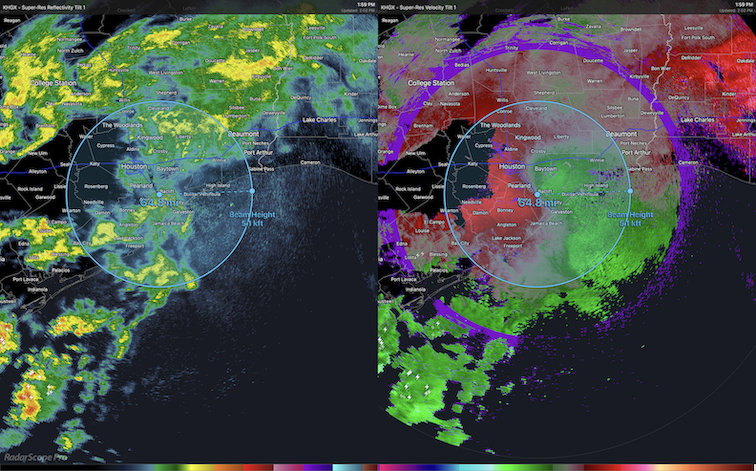
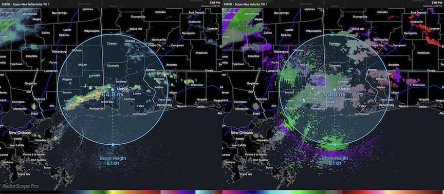
Birders in other coastal areas along the Gulf of Mexico should also prepare for birding with the arrival of precipitation along this frontal boundary. Birds are inbound to the Mississippi and Alabama coasts now as well, likely to encounter precipitation in the coming afternoon hours. The imagery below comes from the Mobile, AL weather surveillance radar. We see the first arrivals of trans-Gulf migrants occurring in the lightly stippled patterns south of the radar in the left image; in the right image, we see the velocity information about these migrants, with green colors representing birds moving toward the radar station.
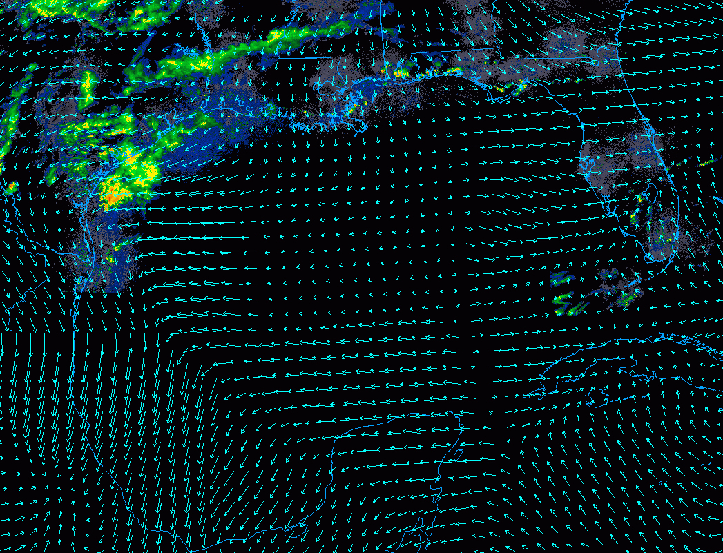
Additional perspective on this movement comes from an overlay of wind speed and direction with the radar mosaic of Gulf Coast radar stations from College of DuPage. Note the blocky and irregular patterns characteristic of precipitation in central and eastern Texas, as well as the more uniform light blue colors of bird migration. So, too, note the wind directions (arrows point toward the direction to which wind is blowing) and speeds (in this case, scaled to the length of the arrow).