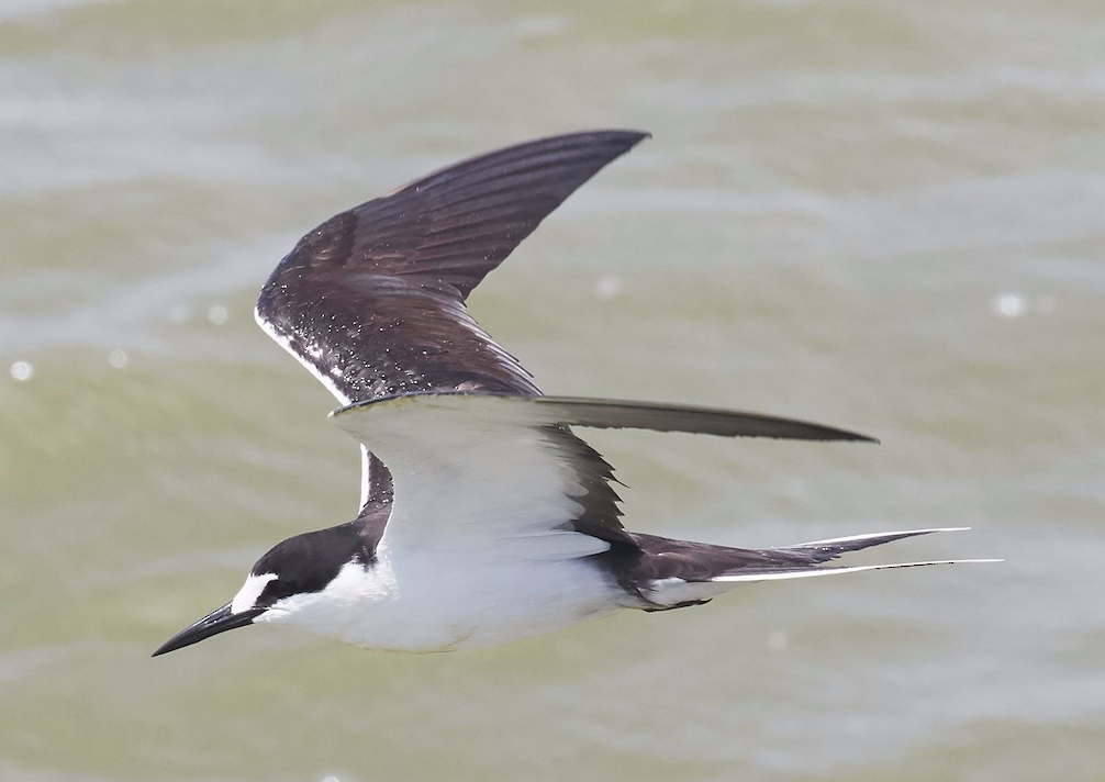
Perhaps the prototypical hurricane and tropical storm bird: Sooty Tern. Andrew Haffenden/Macaulay Library. eBird S37761252.
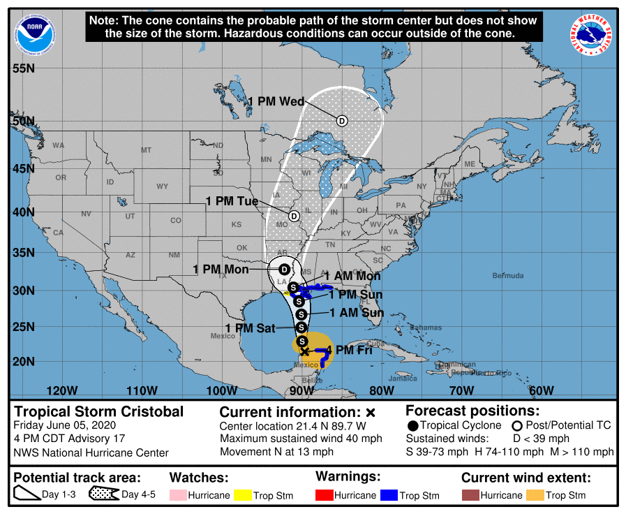
Despite two pre-hurricane season tropical systems, we are now officially over the 1 June hurdle. And here comes Tropical Storm Cristobal, forecast to make landfall in southeastern Louisiana on Sunday evening 7 June. Before we discuss the avian potential (revisit this post, please!), please remember safety above all else: hurricanes and tropical storms are dangerous, and physical distance is more important now than ever in this stage of the evolving pandemic.
Storms originating in the Gulf of Mexico at this time of year could produce an array of seabirds, most notably perhaps Sooty Tern and Magnificent Frigatebird. A previous storm, Tropical Storm Cindy, for example, may be a good indication of what is to come. Reports of Sooty Tern (e.g. here), Bridled Tern (e.g. here), Brown Noddy, and Magnificent Frigatebird (see this and this for examples), including this individual far from the Gulf of Mexico, are all indicative of the haul of species likely to be entrained and then displaced by this storm.
If the current track holds, and IF there are safe viewing locations in coastal Mississippi and Alabama that escape coastal flooding, sea watching may be a strategy for finding hurricane-borne birds. So, too, IF viewing conditions are safe (e.g. beware flooding) in Arkansas and winds are still sufficiently intense as Cristobal moves inland, lakes, rivers, and reservoirs may attract and hold such birds.