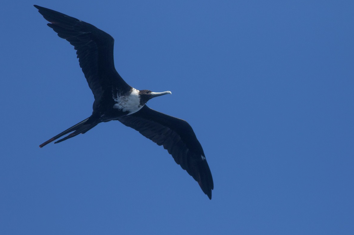
Magnificent Frigatebirds are exceptional aerialists, with a tremendous potential for and history of long-distance vagrancy. We expect significant numbers of this species to occur in and near the path of Hurricane Michael as it moves through the southeastern US. Jack Rogers/Macaulay Library. eBird S48708391.
IMPORTANT: If you are in the path of this powerful, devastating and very dangerous storm, heed all forecasts and warnings from the National Hurricane Center (NHC). Remember also that strong winds are but one of the dangers of tropical storms, and that dangers of storm surges and of flooding are also life-threatening and devastating. NEVER put yourself in a situation where such risks may cut off escape routes or force you into unnecessarily hazardous positions. ***Always put safety of yourself and others before birding.***
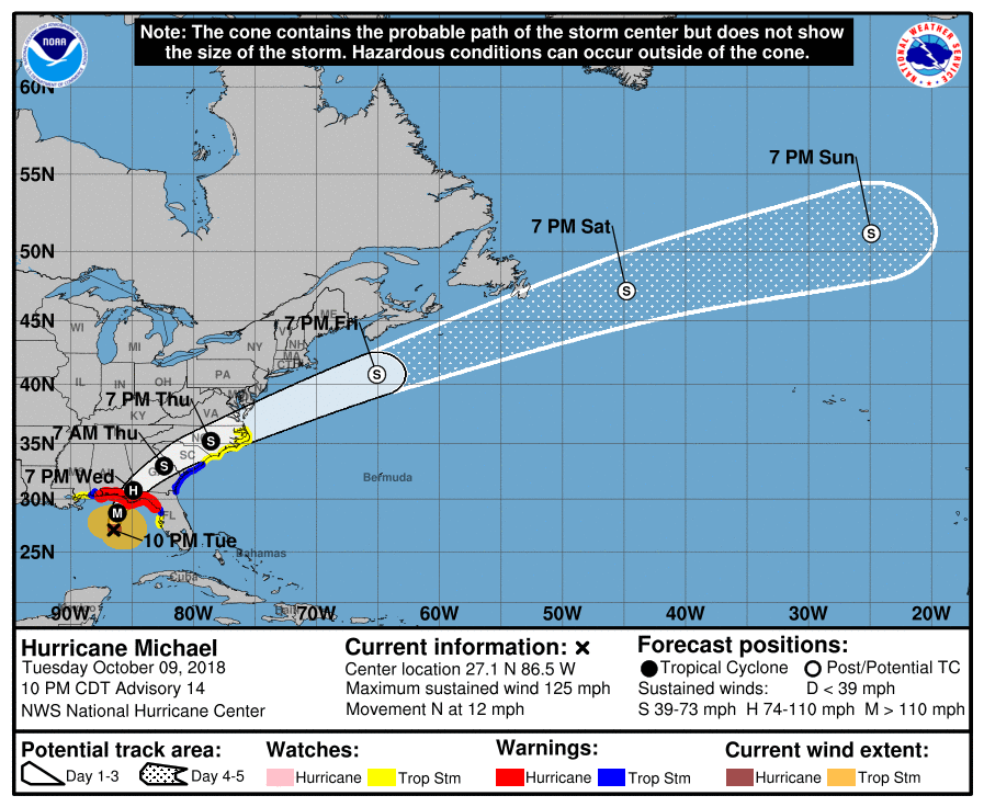
Hurricane Michael strengthened rapidly into a major hurricane on Tuesday, and models are predicting a landfall in the Florida Panhandle on Wednesday. This is a powerful and very dangerous storm, and as with previous storms on which BirdCast reported it may have dramatic impacts on local and transient bird communities and their habitats when it comes ashore (and for certain on human interests in the region). Whereas Rosa’s arrival in the Pacific saw significant weakening as it approached its eventual landfall location and traveled inland, Michael will remain intense at and just after landfall; and although Rosa clearly “dropped” most or all of its avian cargo that it was transporting (our hopes for a windfall of storm waifs certainly did not become reality!), Michael seems poised for a different outcome.
This and other tropical storms (for example, Irma in 2017) often trap (or ‘entrain’) birds in their circulations, depositing them far from birds’ points of origin. We still, very clearly, do not understand many of the mechanisms involved in birds ‘entrainment’ (or not!) and eventual deposition by storms, which is a primary reason for our interest in observations of species associated with these storms.
See live sightings of species we expect may be displaced by Michael here beginning 10 October 2018. (If you get a “disconnected” message, click “Reload”.) Not all observations may be directly related to the storm. The red track shows the path of Michael’s eye.
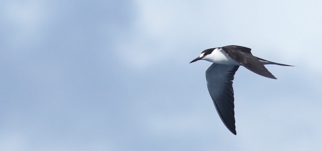
Sooty Terns are perhaps the quintessential “hurricane birds,” often transported by storms. This storm seems particularly likely to deposit individuals of this species inland, given its origins and intensification in the Caribbean and Gulf of Mexico. Photo by Andrew Dreelin/Macaulay Library.
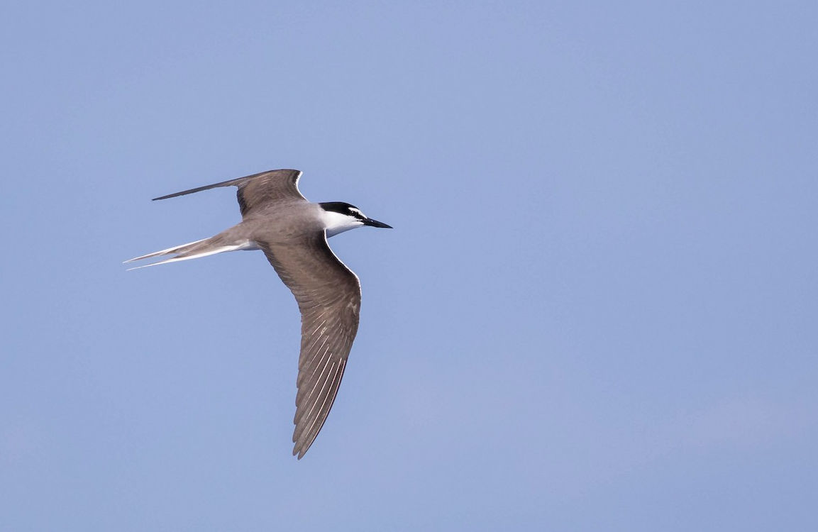
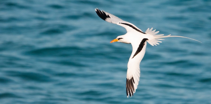
Bridled Tern is another typical storm waif that we expect to occur inland with the passage of Michael. Noah Frade/Maculay Library. eBird S37492990.
Other species may also occur in the wake of Michael’s passage. Although less likely than the previous three potential vagrants, White-tailed Tropicbird may be displaced, as has this species by numerous other recent hurricanes. Photo by Frantz Delcroix/Macaulay Library
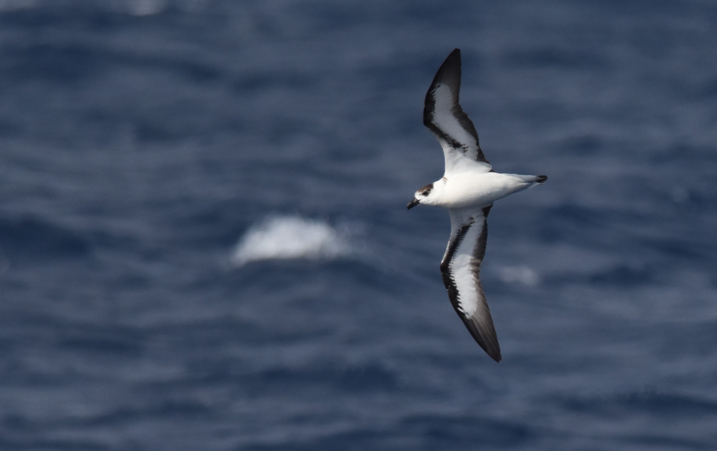
Black-capped Petrels have been sighted frequently off the Atlantic Coast in summer 2018. There are typically very few individuals of this species in the Gulf of Mexico, but will the inland southeast see the appearance of one or two? Similar to the likelihood of White-tailed Tropicbird, these petrels would be an excellent find on the inland bodies of water in the southeastern US. Sean Sime/Macaulay Library.
Real-time sightings from your eBird checklists will appear in the above map and help us understand more details about how these storms transport birds and how birds respond to extreme disturbances in their annual cycles. If you do survey a site for birds, two things to remember: SAFETY FIRST and please keep a detailed eBird list. And if you note storm birds, please take note of the time that you observe them, as this helps to understand how birds move with and within the storm.
As an aside, many people are curious about how birds migrating over land respond to the arrival and passage of hurricanes. Check out our migration forecast and live tracking maps to see for yourself! In the wake of such storms’ passages, mass movements of migrants typically occur.